859 Miles
1'383 Km
8 States/Provinces
6 Cities
1 Interstate
7 Bridges
4 Rivers
1 Lake
| |
|
10 Days
859 Miles 1'383 Km 8 States/Provinces 6 Cities 1 Interstate 7 Bridges 4 Rivers 1 Lake |
| Day #01 - Thu, 14/08/2008 | |||||
| Km 0000 - New York State | NY |  |  | ||
| Km 0000 - New York City: Manhattan: Midtown | |||||
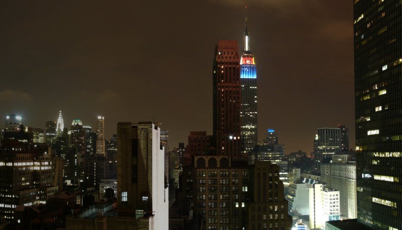 | Midtown seen from the window of the New Yorker Hotel, looking east. The Crysler Building is lit up far away on the left and the Empire State Building is in the center. | ||||
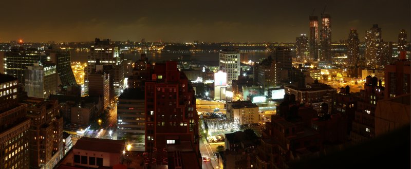 | The Hudson River seen from the window of the New Yorker Hotel, looking west. On the right, the new skyscrapers in the Hell's Kitchen neighborhood. | ||||
| Day #02 - Fri, 15/08/2008 | |||||
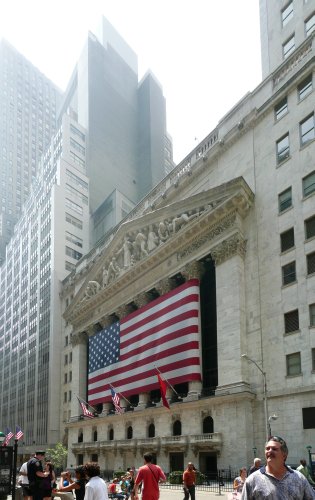 | The New York Stock Exchange on Wall Street. | ||||
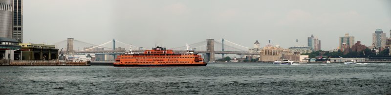
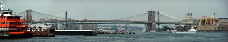 | The Brooklyn Bridge seen from the Staten Island Ferry while docked at the Manhattan terminal, looking north-west. Behind the Brooklyn Bridge, the Manhattan Bridge (blue) and, further back, the east tower of the Williamsburg Bridge. The Brooklyn neighborhood on the right is DUMBO, a.k.a. "Down Under the Manhattan Bridge Overpass". | ||||
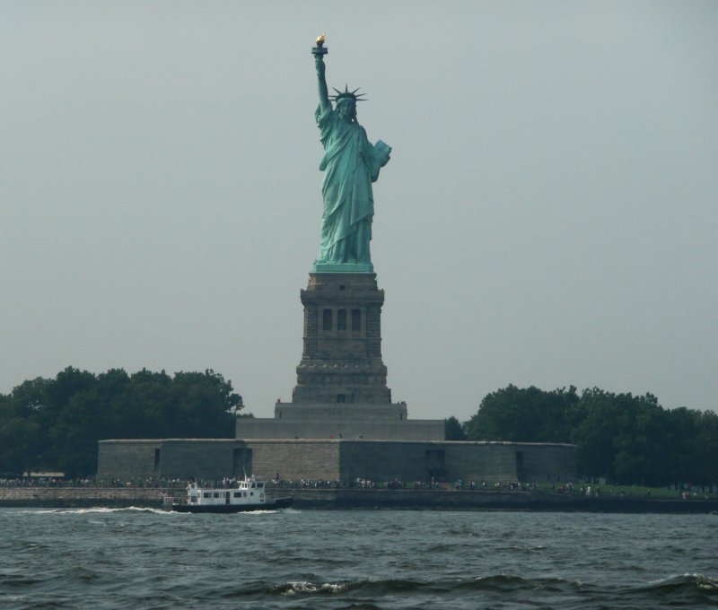 | The Statue of Liberty seen from the Staten Island Ferry, looking north-west. | ||||
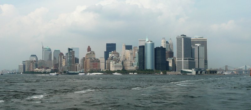 | The Financial District in Lower Manhattan seen from the Staten Island Ferry, looking north-east. The Twin Towers of the World Trade Center would have stood on the left, where there's now a crane. | ||||
 | The Staten Island Ferry docking at the Manhattan terminal. | ||||
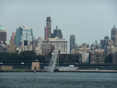 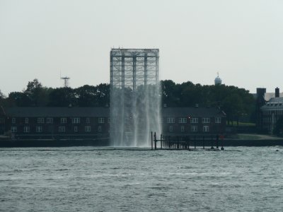
 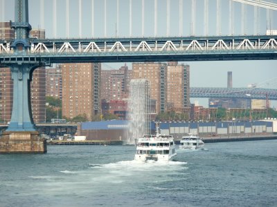
| The New York Waterfalls. A "decoration" of the East River for the summer of 2008. | ||||
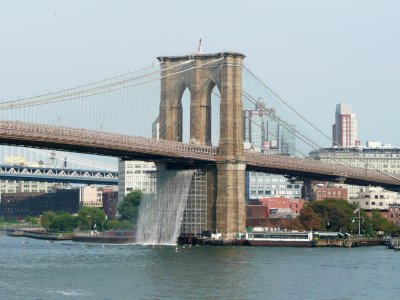
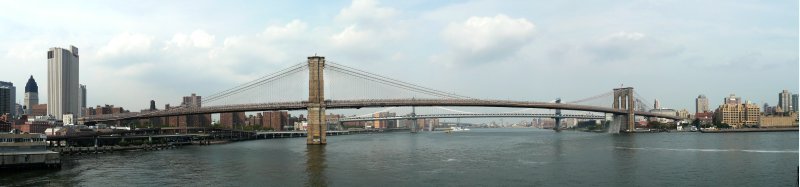 | The Brooklyn Bridge seen from the second floor of the Pier 17 mall, looking east. Behind the Brooklyn Bridge (brown), the Manhattan Bridge (blue). On the right, Watchtower building (Jehova's Witnesses official publication). | ||||
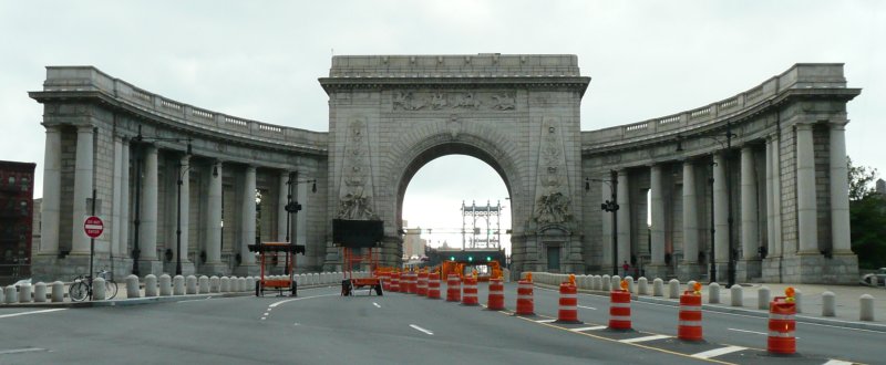 | The entrance to the Manhattan Bridge on the Manhattan side, at the end of Canal Street in Chinatown. | ||||
| Day #03 - Sat, 16/08/2008 | |||||
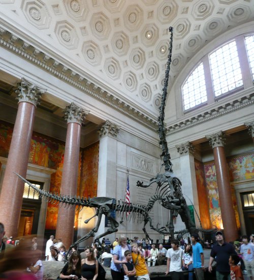 | The entrance to the American Museum of Natural History. | ||||
| Km 0003 - New York City: Manhattan: Park Avenue and Grand Central Station | |||||
| Km 0005 - New York City: Manhattan: Broadway and Union Square | |||||
| Km 0009 - New York City: Brooklyn Bridge | |||||
| Km 0023 - New York City: Staten Island: Verrazano-Narrows Bridge | |||||
| Km 0049 - New York City: Staten Island: Outerbridge Crossing | |||||
| Km 0049 - New Jersey | NJ |  |  | ||
| Km 0211 - Cowtown Rodeo | |||||
| Km 0225 - Delaware | DE |  |  | ||
| Km 0225 - Delaware Memorial Bridge | |||||
| Km 0247 - Texas Roadhouse | |||||
| Km 0266 - Maryland | MD |  |  | ||
| Km 0344 - Baltimore | |||||
| Km 0406 - District of Columbia | DC |  |  | ||
| Km 0417 - Washington: Georgetown | |||||
| Day #04 - Sun, 17/08/2008 | |||||
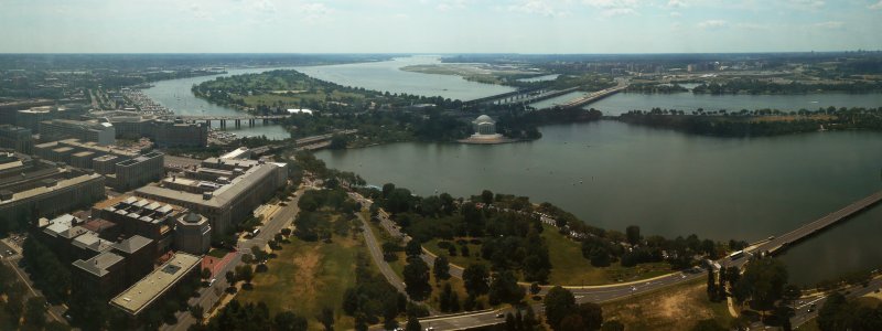 | The Tidal Basin and the Potomac River seen from the top of the Washington Monument, looking south. In the center, the Jefferson Memorial. | ||||
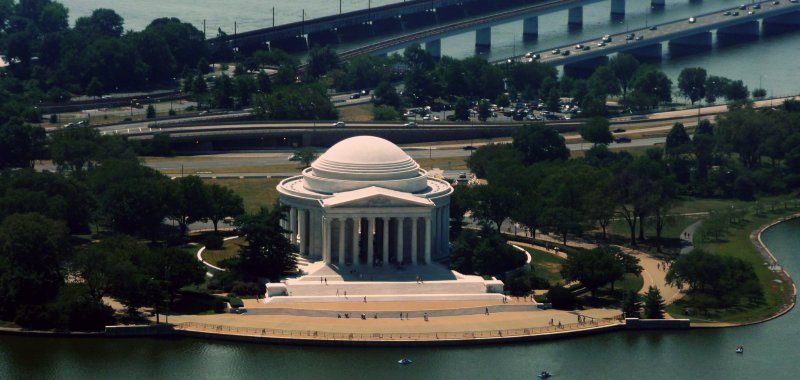 | The Jefferson Memorial seen from the top of the Washington Monument, looking south. | ||||
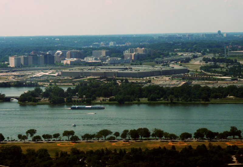 | The Pentagon in Arlington, Virginia, on the right bank of the Potomac River, seen from the top of the Washington Monument, looking south-west. | ||||
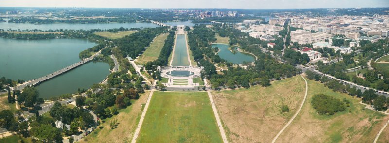 | Looking west from the top of the Washington Monument. In the center of the picture, from top to bottom: Arlington, Virginia; the Potomac River; the Lincoln Memorial; the Reflecting Pool; the World War II Memorial. On the left, the Tidal Basin; on the right, the Foggy Bottom neighborhood. | ||||
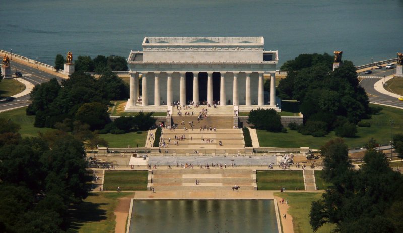 | The Lincoln Memorial seen from the top of Washington Monument, looking west. | ||||
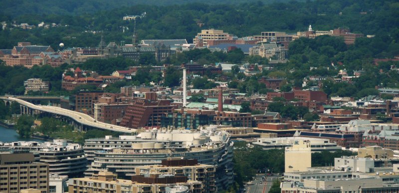 | Georgetown seen from the top of the Washington Monument, looking north-west. This is the setting of "The Exorcist". | ||||
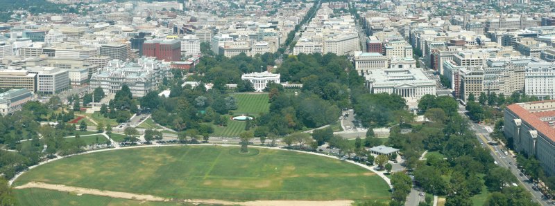 | The White House seen from the top of the Washington Monument, looking north. On the left of the White House, the Old Executive Office; on the right, the Department of Treasury; in the front the Ellipse of President Park South. | ||||
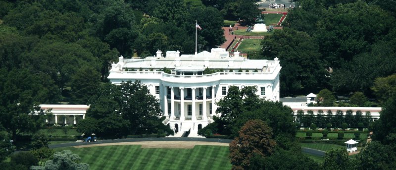 | The White House seen from the top of the Washington Monument, looking north. Behind the White House, Lafayette Park. | ||||
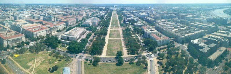 | The National Mall seen from the top of the Washington Monument, looking east. The museums of the Smithsonian Institution are on both sides and, at the end, the US Capitol. | ||||
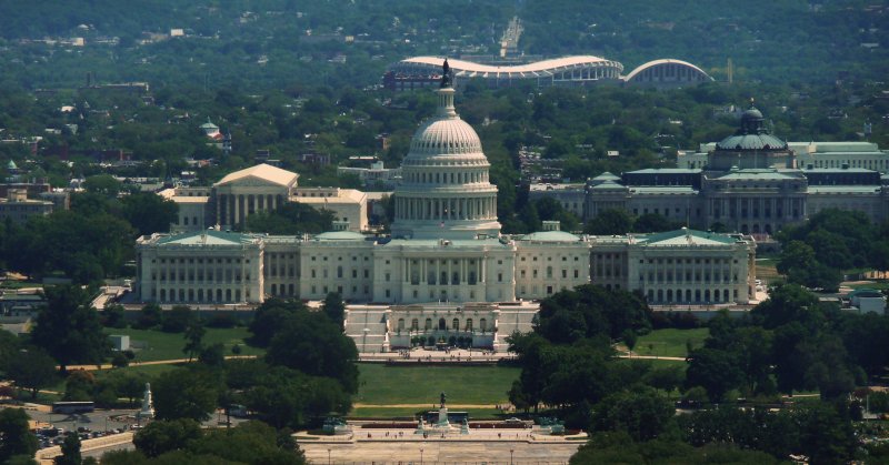 | The US Capitol seen from the top of the Washington Monument, looking east. Right behind it, the Supreme Court on the left and the Library of Congress on the right. In the background, the Robert F. Kennedy baseball stadium and, on its right, shaped like an arch, the DC Armory. | ||||
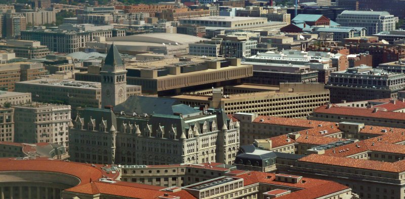 | Looking north-east from the top of the Washington Monument: the Old Post Office, with the blue roof, and, behind it, of a yellow-orange color, the J. Edgar Hoover Building, a.k.a. the FBI headquarters. | ||||
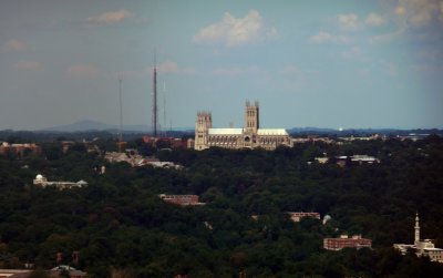 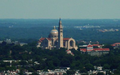 | The National Cathedral (left) and the Basilica of the National Shrine of the Immaculate Conception (right) seen from the top of the Washington Monument, looking respectively north-west and north-east. | ||||
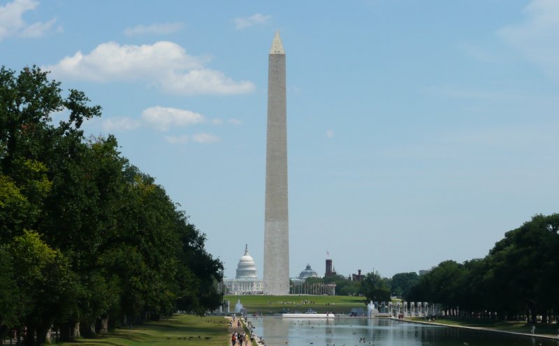 | The Washington Monument and, behind it, the US Capitol. | ||||
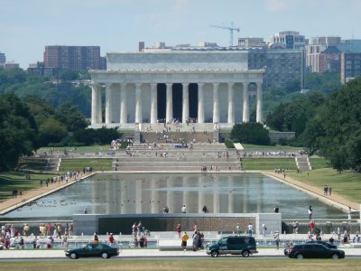  | The facade and interior of the Lincoln Memorial. | ||||
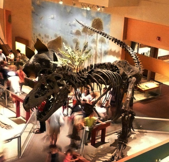 | The T-Rex in the National Museum of Natural History. | ||||
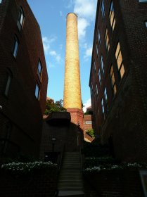 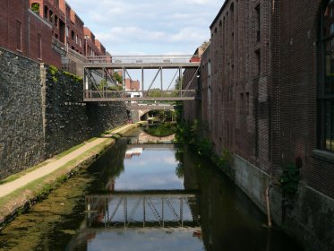 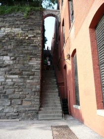 | Around the Chesapeake and Ohio Canal in Georgetown. The stairs are the ones in "The Exorcist" movie. | ||||
| Km 0428 - Maryland | MD | | | ||
| Km 0484 - Chesapeake Bay Bridge | |||||
| Km 0566 - Delaware | DE | | | ||
| Km 0613 - Delaware Memorial Bridge | |||||
| Km 0613 - New Jersey | NJ | | | ||
| Km 0723 - Atlantic City: Boardwalk | |||||
| Day #05 - Mon, 18/08/2008 | |||||
| Km 0842 - Skydive Jersey Shore | |||||
| Km 0962 - Atlantic City: Boardwalk | |||||
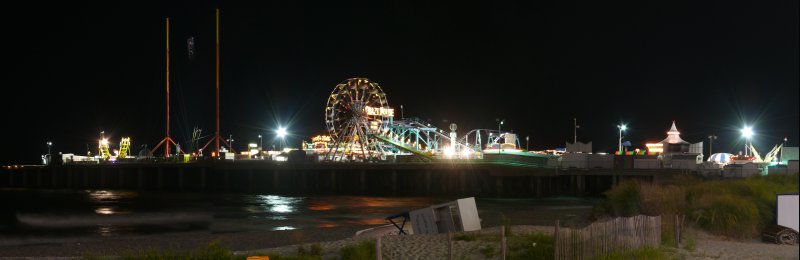 | The amusement park on the Steel Pier. | ||||
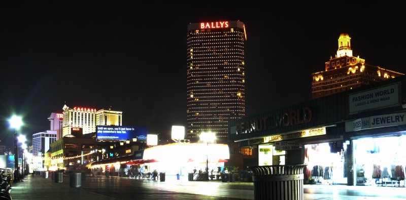 | The Caesars and the Bally's at night. | ||||
 | The Boardwalk. | ||||
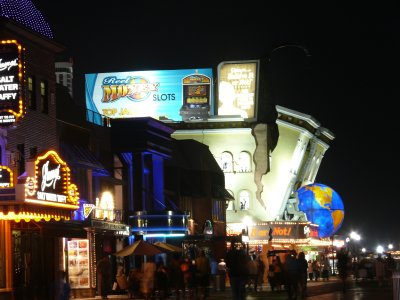 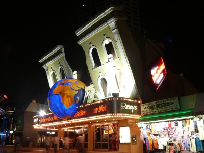 | Ripley's Believe It Or Not museum on the Boardwalk. | ||||
| Day #06 - Tue, 19/08/2008 | |||||
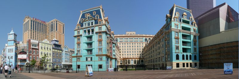 | The Caesars and Bally's in daylight. | ||||
| Km 1054 - Pennsylvania | PA |  |  | ||
| Km 1054 - Walt Whitman Bridge | |||||
| Km 1059 - Philadelphia: Best Buy | |||||
| Km 1111 - New Jersey | NJ | | | ||
| Km 1203 - New York State | NY | | | ||
| Km 1203 - New York City: Staten Island: Outerbridge Crossing | |||||
| Km 1229 - New York City: Staten Island: Verrazano-Narrows Bridge | |||||
| Km 1242 - New York City: Brooklyn: Brooklyn Heights | |||||
| Km 1250 - New York City: Brooklyn-Queens Expressway | |||||
| Km 1254 - New York City: Queens: Queens Boulevard | |||||
| Km 1259 - New York City: Manhattan: Queensboro Bridge (59th Street Bridge) | |||||
| Km 1261 - New York City: Manhattan: FDR Drive South | |||||
| Km 1265 - New York City: Manhattan: Midtown | |||||
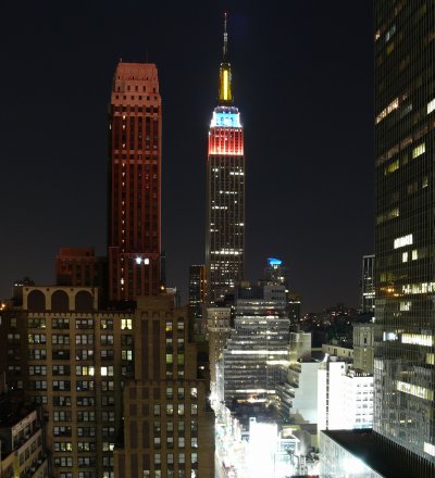 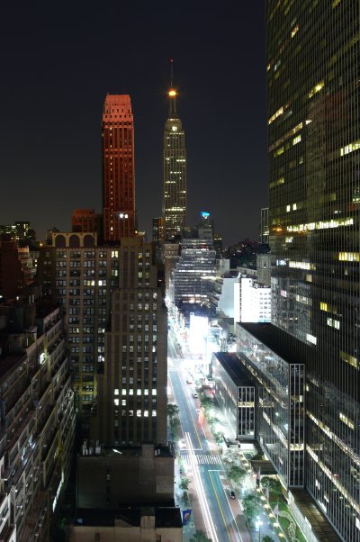 | The Empire State Building seen from the New Yorker Hotel, looking east. The lit up street is West 34th Street, with the black One Penn Plaza building on its south side (right in the picture). | ||||
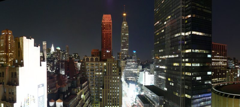 | Midtown seen from a window of the New Yorker Hotel, looking east. The Crysler Building is lit up far away on the left, the Empire State Building in the center and the black One Penn Plaza building is on the right, in front of the Madison Square Garden, in the lower right corner. | ||||
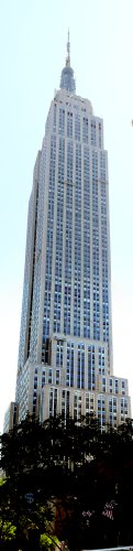 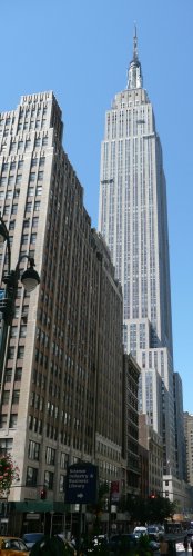 | The Empire State Building seen from West 34th Street, looking east, and from East 34th Street, looking west. | ||||
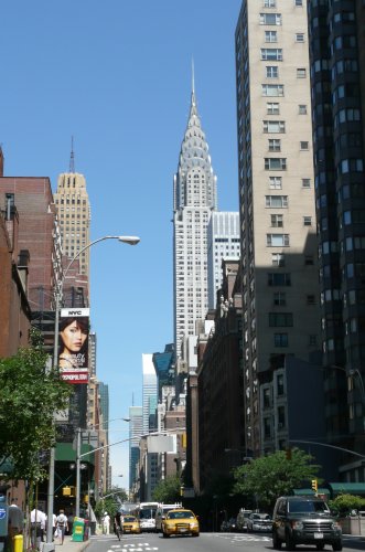 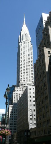 | The Crysler Building seen from Lexington Avenue, looking north. | ||||
| Day #07 - Wed, 20/08/2008 | |||||
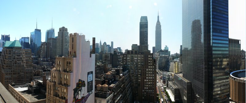 | Midtown seen from a window of the New Yorker Hotel, looking east. | ||||
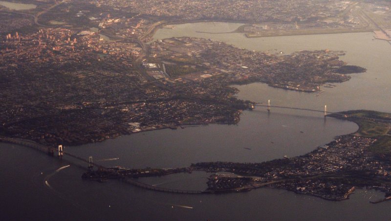 | The easternmost bridges between Queens (on the left) and the Bronx (on the right) seen from the late afternoon JFK-BUF flight, looking south west. The bridge on the left is the Throgs Neck Bridge and the one on the right is the Bronx-Whitestone Bridge. La Guardia Airport is in the upper right corner. | ||||
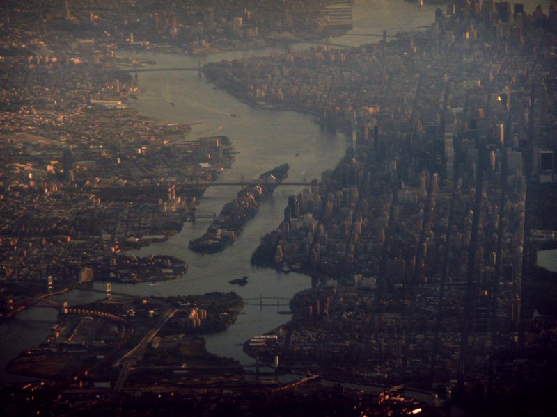 | The East River seen from the late afternoon JFK-BUF flight, looking south-west. From top (south) to bottom (north), the bridges are: Brooklyn Bridge, Manhattan Bridge, Williamsburg Bridge, Queensboro Bridge (over Roosevelt Island, in the center of the picture), the small bridge between Queens and Roosevelt Island, the Triborough Bridge and the Hell Gate Bridge (a railway bridge, in the lower left corner) and small bridges over the Harlem River (lower center). | ||||
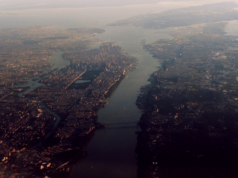 | New York City seen from the late afternoon JFK-BUF flight, looking south. In the upper left, the boroughs of Queens and Brooklyn; in the lower left, the Bronx; in the center, Manhattan; on the right, New Jersey; in the upper right, Staten Island. The bridge in the foreground over the Hudson River connecting Manhattan to New Jersey is the George Washington Bridge (opened in 1931, currently the 16th longest suspension bridge in the world, with a central span of 3500 feet). The cluster of skyscrapers above Central Park is the Midtown section of Manhattan. | ||||
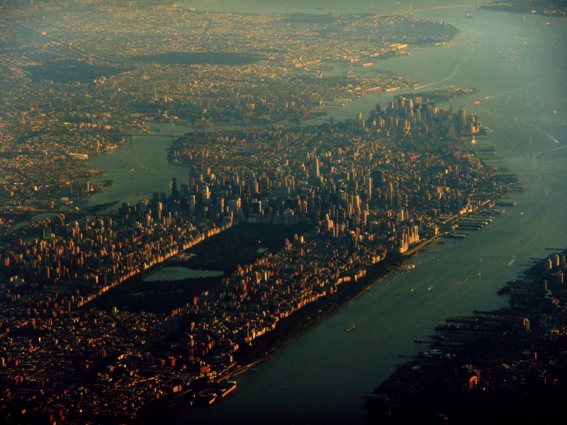 | Manhattan seen from the late afternoon JFK-BUF flight, looking south. | ||||
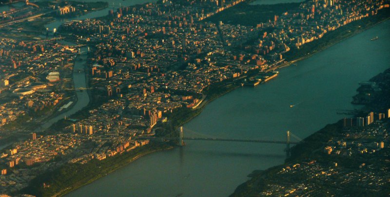 | Harlem seen from the late afternoon JFK-BUF flight, looking south. From left to right: the Bronx, the Harlem River, Harlem (the part of Manhattan north of Central Park), the Hudson River and New Jersey. The bridge in the foreground is the George Washington Bridge. | ||||
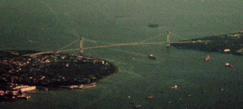 | The Verrazano-Narrows Bridge seen from the late afternoon JFK-BUF flight, looking south. Opened in 1934, it currently is the 8th longest suspension bridge in the world, with a central span of 4260 feet, connecting Brooklyn to Staten Island over the Narrows at the mouth of the New York Bay. Giovanni da Verrazano is the Italian explorer who first navigated the New York Bay in 1524. | ||||
| Km 1265 - Buffalo-Niagara International Airport | |||||
 | The skyline of the Canadian side of Niagara Falls seen from the late afternoon JFK-BUF flight, looking north-west during landing at the Buffalo-Niagara airport (25 miles away). | ||||
| Km 1307 - Rainbow Bridge | |||||
| Km 1307 - Ontario (Canada) | ON |  |  | ||
| Km 1309 - Niagara Falls (Ontario, Canada) | |||||
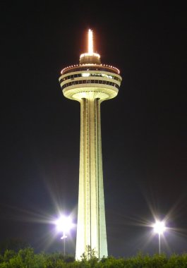 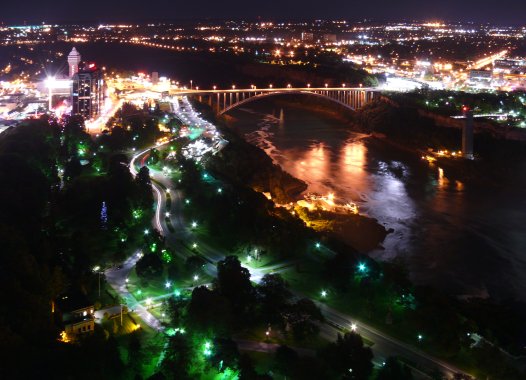 | The Skylon Tower seen from Clark Ave, looking south-east, and the Rainbow Bridge seen from the Skylon Tower, looking north-east. On the left of the bridge, the Niagara Casino on Clifton Hill (Canada) and, on the right, the Observation Deck of Prospect Point (USA). | ||||
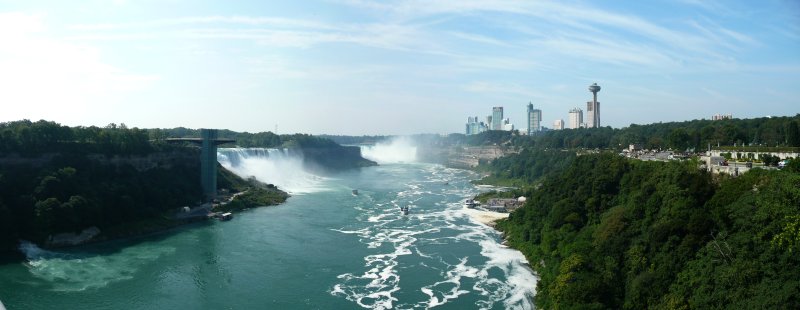
 | The Niagara Falls seen from the Skylon Tower, looking east. From left to right: the Rainbow Bridge, the American Fall, the Bridal Veil Fall (small and lit up in red, on the immediate rightof the American Fall), Goat Island (dark in the middle) and the Horseshoe Fall. | ||||
| Day #08 - Thu, 21/08/2008 | |||||
| Km 1313 - Niagara Whirlpool | |||||
| Km 1317 - Niagara Glen | |||||
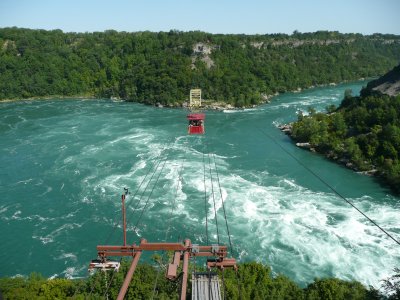 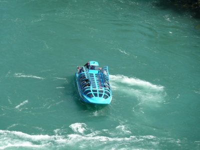 | The Whirlpool Aero Car (also known as Spanish Car) over the Niagara Whirlpool and the JetDome jet boat, standing next to the whirlpool. | ||||
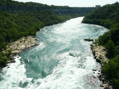 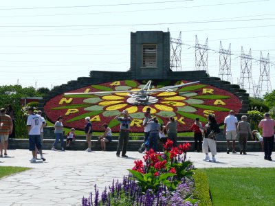 | The rapids above the Whirlpool seen from the Aero Car, looking south-east, and the Floral Clock behind the 2 Canadian hydroelectric power plants. | ||||
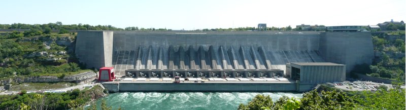 | The Robert Moses US hydroelectric power plant seen from the Canadian side, looking east from the south side of the Adam Beck II Canadian power plant. | ||||
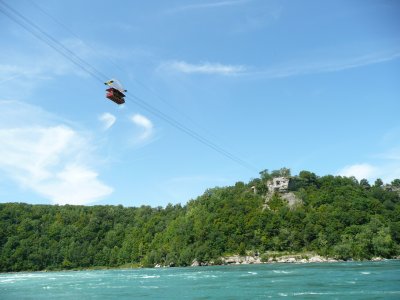 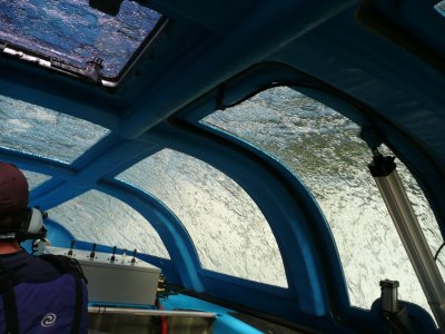 | The Aero Car seen from the JetDome boat standing next to the Whirlpool and the rapids below the Whirlpool seen from inside the jet boat. | ||||
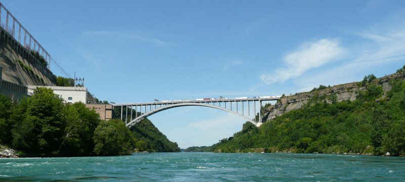 | The Queenston-Lewiston Bridge seen from the JetDome boat, looking north. On the left, the Canadian hydroelectric power plant Adam Beck I and, on the right, the US bank. | ||||
| Km 1324 - Niagara Falls (Ontario, Canada) | |||||
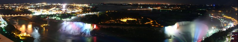
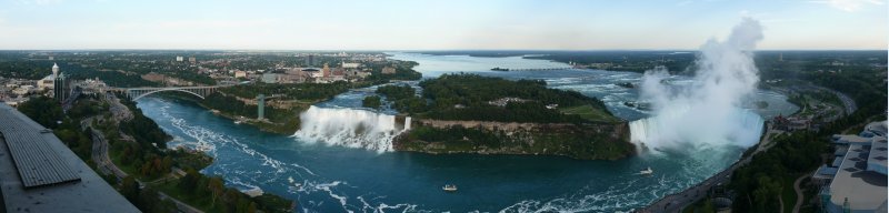
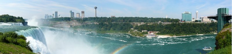
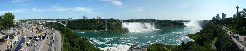 | Niagara Falls seen from the second floor of the ticket office of the Canadian Maid of the Mist, looking in a 180° arc from the north-east to the south-west. From left to right: the Rainbow Bridge (the Canada/US border crossing), Prospect Point (the observation deck at the entrance to the US Maid of the Mist, built in 1960 to replace the natural outcropping collapsed on June 28th 1954, damaging the old elevators), the American Fall, Luna Island (the rock in between the American Fall and the Bridal Veil Fall), the Bridal Veil Fall (the small fall), Goat Island (its right side is the US/Canada border), the Horseshoe Fall and the Skylon Tower. | ||||
  | The American Fall seen from Table Rock and the Horseshoe Fall seen from the Incline Railway (on the hill next to the fall). | ||||
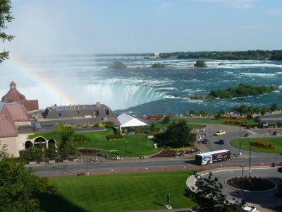
 | The afternoon rainbow over the Horseshoe Fall, seen from Table Rock. | ||||
 | Niagara Falls seen from the Skylon Tower. | ||||
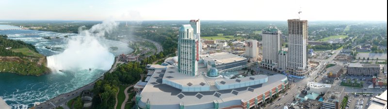 | The Horseshoe Fall and the Fallsview Casino seen from the Skylon Tower. | ||||
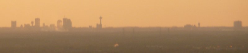
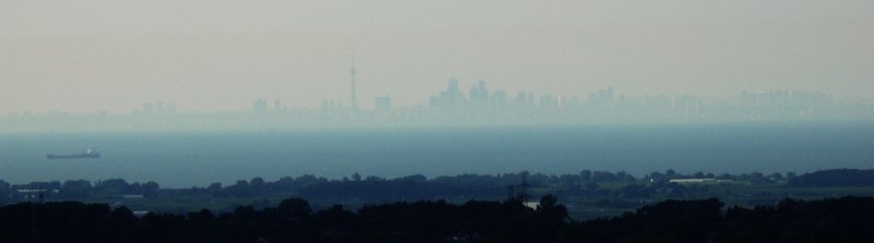 | The Toronto skyline on the shore of Lake Ontario, seen from the Skylon Tower looking north-north-west at a distance of 40 miles. The CN Tower (just left of the center) and a ship on the lake are clearly visible. The CN Tower was built in 1975 and remained the tallest building in the world (at 1815 feet) until 2007, when it was surpassed by the Burj Dubai skyscraper in Dubai, while still under construction (it topped off in 2009 at 2717 feet). | ||||
 | The North Grand Island Bridge along I-190 in the US. | ||||
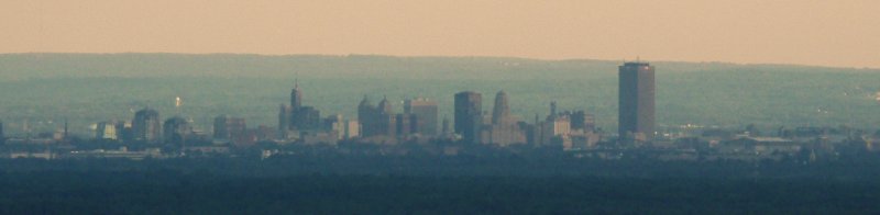 | The Buffalo skyline on the shore of Lake Erie, seen from the Skylon Tower looking south-east at a distance of 17 miles. The Buffalo City Hall is clearly visible (the pyramid-shaped building just right of the middle). | ||||
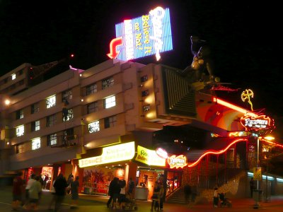 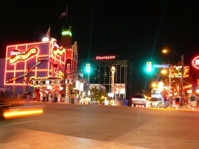 | The Ripley's Believe It Or Not museum on Clifton Hill and the top of Clifton Hill. | ||||
| Day #09 - Fri, 22/08/2008 | |||||
| Km 1326 - Rainbow Bridge | |||||
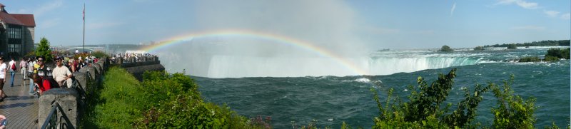
 | Niagara Falls seen from the south side of the Rainbow Bridge, walking from Canada (right) to the US (left) and looking south-west. | ||||
| Km 1326 - New York State | NY | | | ||
| Km 1327 - Niagara Falls (New York, USA) | |||||
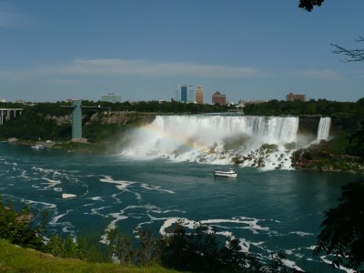
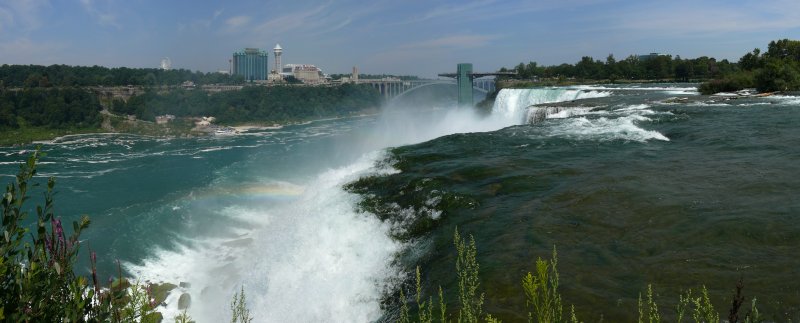
 | Niagara Falls seen from Prospect Point. | ||||
 | The American Fall seen from Luna Island, looking north-east. | ||||
| Km 1359 - Buffalo | |||||
| Km 1383 - Buffalo-Niagara International Airport | |||||
| Km 1383 - Massachusetts | MA |  |  | ||
| Km 1383 - Boston | |||||
 | Boston seen from the BUF-BOS flight, looking east. From top to bottom: Logan International Airport, the Boston Harbour, Boston, the Charles River and Cambridge. Along the Charles River, from left to right: the Leonard P. Zakim Bunker Hill Memorial Bridge, the Charles River dam, the Longfellow Bridge. | ||||
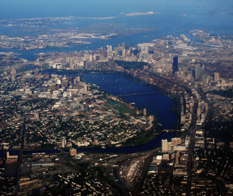 | Boston seen from the BUF-BOS flight, looking east. Cambridge in on the left, Boston on the right. The MIT and the NASA Mission Control are on the Cambridge side, where the Charles River widens. On the Boston side, the Back Bay with the Hancock Tower (the dark lonely skyscraper) and the Prudential Tower (on the right of the Hancock Tower). | ||||
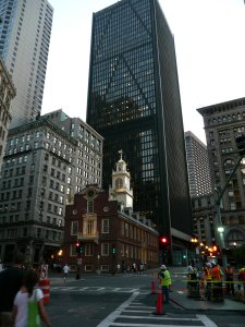 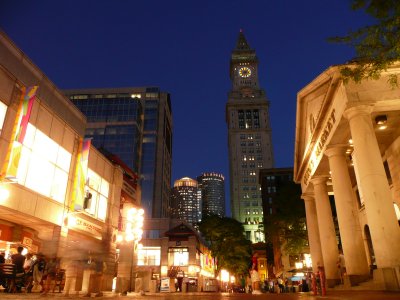 | The Old State House and, behind it, the One Boston Place building, seen from State Street looking west, and the Marriott's Custom House (the watch tower) and the 2 buildings of the International Place, seen from Commerce Street, on the eastern end of Quincy Market, looking south. | ||||
| Day #10 - Sat, 23/08/2008 | |||||
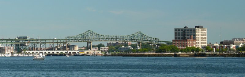 | The Tobin Memorial Bridge at the mouth of the Mystic River seen from the Boston Harbour, looking north. | ||||
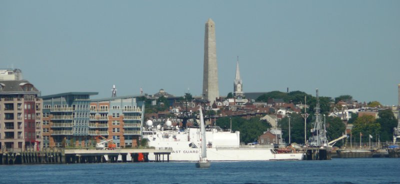 | The Bunker Hill Monument seen from Boston Harbour, looking north-west. | ||||
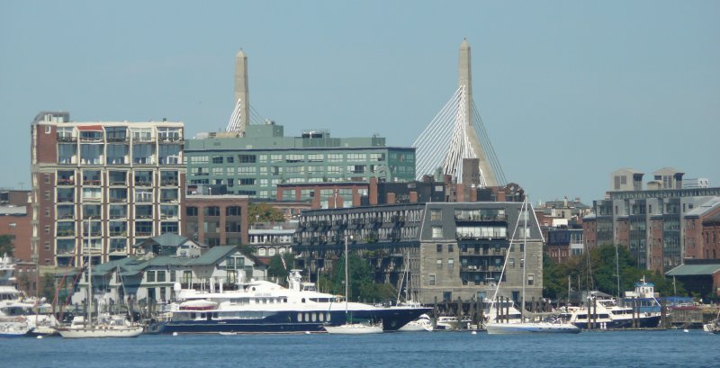 | The towers of the Leonard P. Zakim Bunker Hill Memorial Bridge seen from the Boston Harbour, looking north-west. | ||||
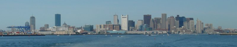 | The Boston skyline seen from the the Boston Harbour, looking west-north-west. | ||||
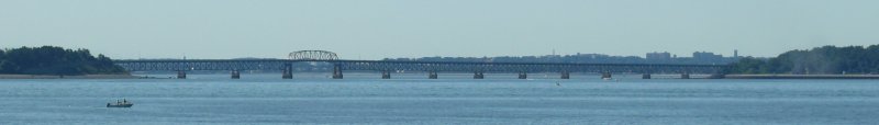 | The Long Island Bridge seen from the Boston Harbour, looking south-east. | ||||
| - Km 1383 - | |||||