1'551 Miles
2'496 Km
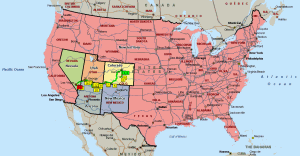
5 States
3 Indian Reservations
3 City
3 National Highways
1 Interstate Highways
2 Dams
3 Bridges
8 Parks
4 Rivers
7 Canyons
2 Deserts
2 Lakes
| |
|
9 Days
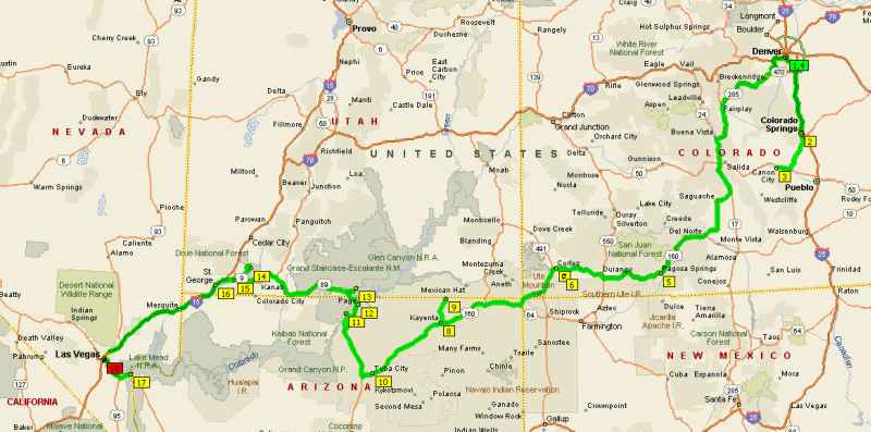
1'551 Miles 2'496 Km 5 States 3 Indian Reservations 3 City 3 National Highways 1 Interstate Highways 2 Dams 3 Bridges 8 Parks 4 Rivers 7 Canyons 2 Deserts 2 Lakes |
| Day #01 - Fri, 16/03/2007 | ||||||
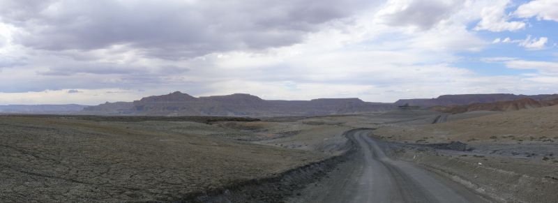
| Km 0000 - Colorado | CO |  |  | |||
| 01 | Km 0000 - Denver International Airport | |||||
| Km 0013 - (I-70) | ||||||
| Km 0030 - Denver | ||||||
| Km 0030 - (I-25) | ||||||
| 02 | Km 0156 - Colorado Springs [night at the Howard Johnson] | |||||
| Day #02 - Sat, 17/03/2007 | ||||||
| Km 0158 - (SR-115) | ||||||
 | ||||||
| Km 0210 - (US-50) | ||||||
| Km 0228 - Cañon City | ||||||
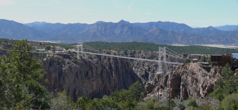
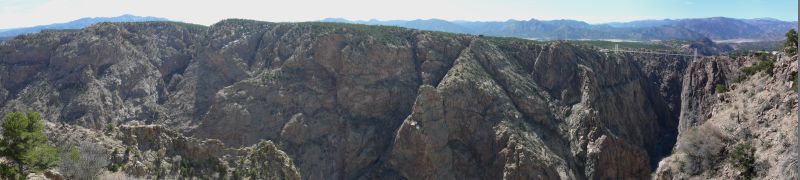
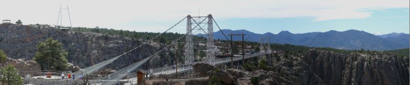
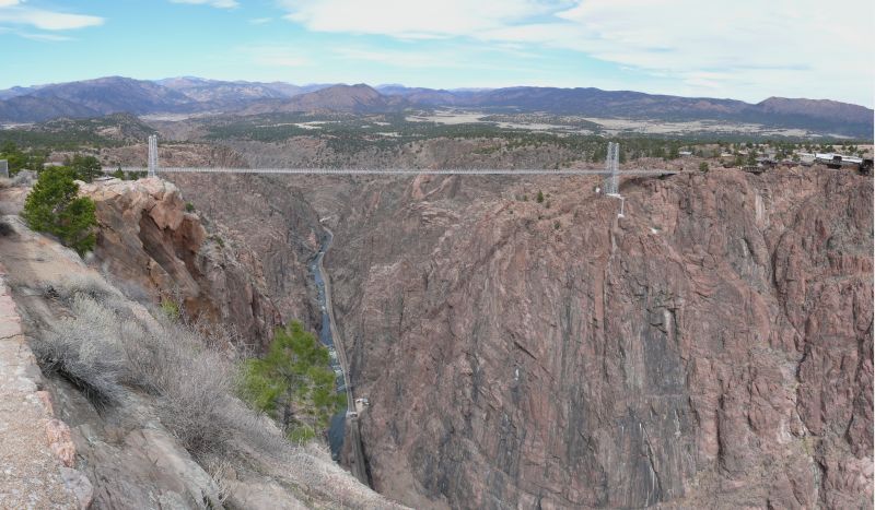
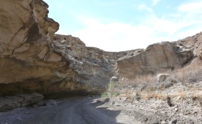
| 03 | Km 0248 - Royal Gorge: Royal Gorge Bridge | |||||
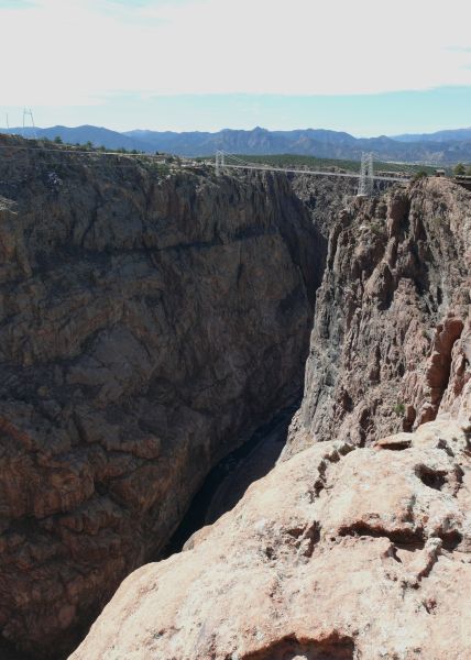 | Built in 1929 in only 6 months as a tourist attraction, it is 938 ft long and 16 ft wide but 1053 ft high above the Royal Gorge of the Arkansas River, which makes it the highest suspension bridge in the world. The towers are 210 ft high and made of steel, same as the cables, however the road deck is made of 1'000 creaking wooden planks! Is is possible to slowly drive over the bridge beside walking. The young Arkansas River flows at the bottom of the gorge, alongside the Denver and Rio Grande Railroad. | |||||
| ||||||
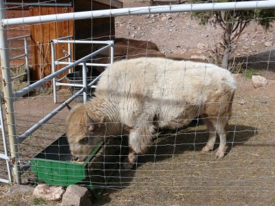  | A white buffalo and some deer. | |||||
| Km 0248 - Royal Gorge: Arkansas River | ||||||
 | ||||||
| Km 0278 - Cañon City | ||||||
| Km 0296 - (SR-115) | ||||||
| Km 0332 - Colorado Springs | ||||||
| Km 0350 - (I-25) | ||||||
| Km 0447 - (I-225) | ||||||
| 04 | Km 0473 - Denver International Airport | |||||
| Km 0507 - (I-70) | ||||||
| Km 0556 - US-285 | ||||||
| Day #03 - Sun, 18/03/2007 | ||||||
| Km 0858 - (SR-112) | ||||||
| Km 0878 - Rio Grande River | ||||||
| Km 0879 - US-160 | ||||||
| 05 | Km 0977 - Pagosa Springs [night, or rather early morning, at the Super 8] | |||||
I arrived on time in Denver at 11pm, but my mother, sister and aunt, who were supposed to already be there waiting for me, were instead snowed in at Newark Airport. After spending over 24 hours at the airport, being in line for hours, walked from one terminal to the other (1/4 of a mile) under the snow and lost the flight, they finally arrived the next day at 1am, so I had to sleep in Colorado Springs and visit the Royal Gorge by myself. After the Royal Gorge however, instead of driving ahead for only 50 more miles on US-50 to Salida in order to arrive at Pagosa Springs in the evening, I had to double back for 156 miles to Denver, where I tried to catch some sleep at the airport while waiting for the others. So I had to drove 170 miles through the mountains at night, to get back on the original route in Salida and arrive at Pagosa Springs at 7am, where I could finally sleep a few hours until 10am and be back on track. The bloody clerk at the motel was sleeping and I wasted a precious half hour to wake him up! | ||||||
| Km 1070 - Durango | ||||||
| Km 1128 - (US-10) | ||||||
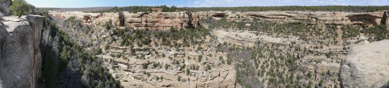
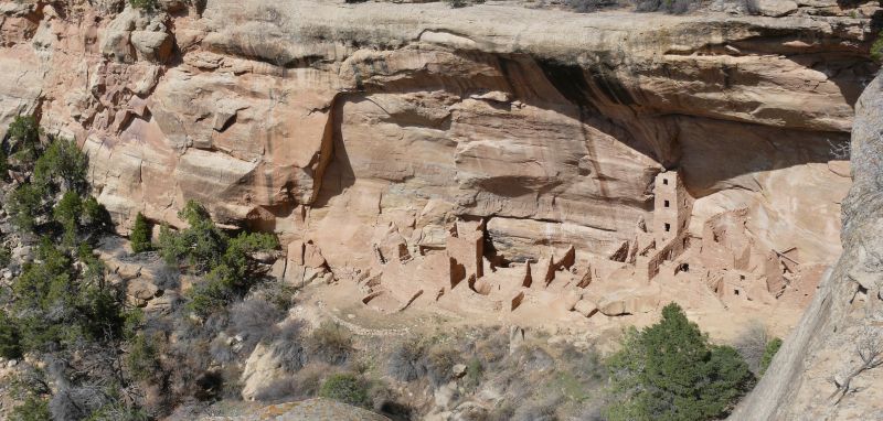
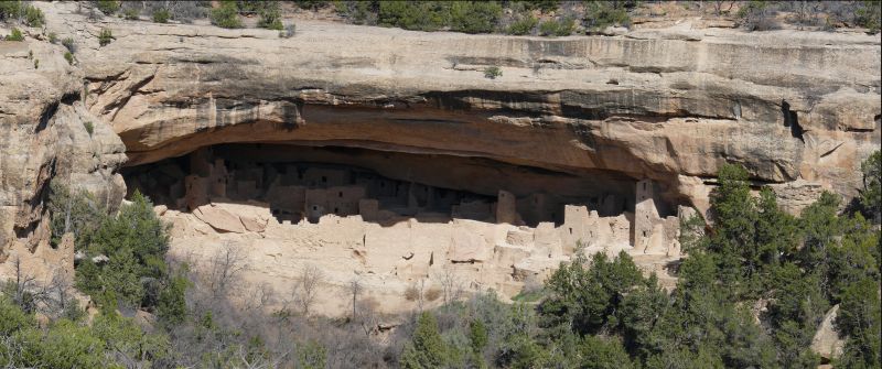
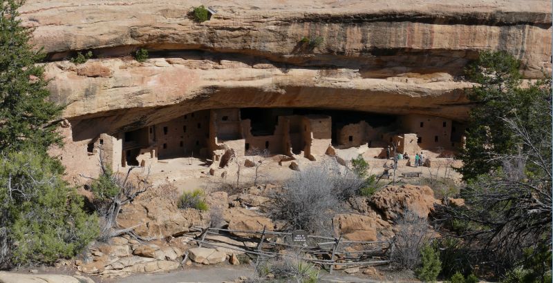
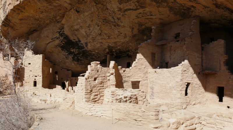
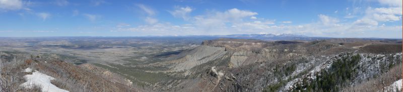
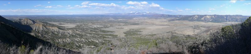
| 06 | Km 1168 - Mesa Verde | |||||
 | ||||||
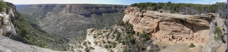
| 06 | Km 1168 - Mesa Verde: Square Tower House | |||||
| ||||||
| 06 | Km 1168 - Mesa Verde: Cliff Palace | |||||
 | ||||||
| 06 | Km 1168 - Mesa Verde: Spruce Tree House | |||||
| ||||||
| Km 1204 - US-160 | ||||||
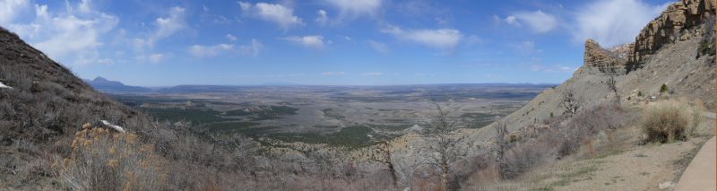
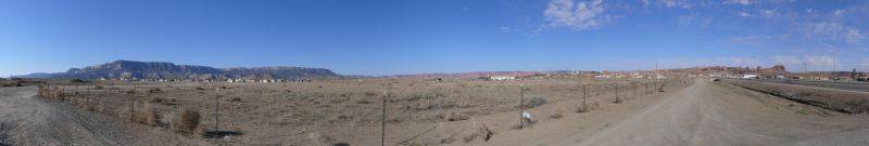
| Km 1210 - Montezuma Valley (seen from Mesa Verde looking north-west) | ||||||
| ||||||
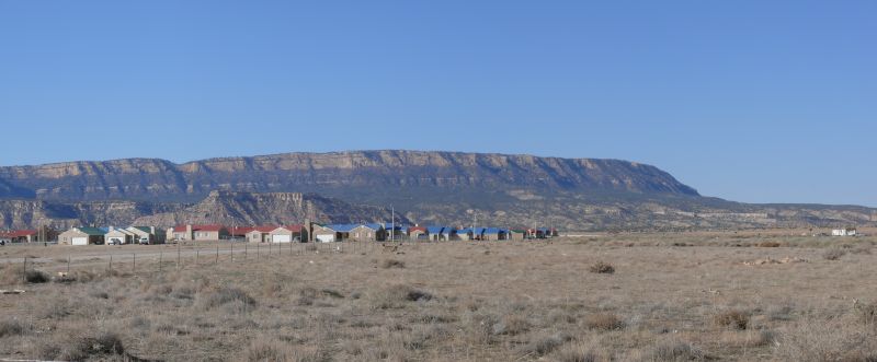
| 07 | Km 1217 - Cortez [dinner at the Dry Dock] | |||||
| Km 1237 - Ute Indian Reservation | ||||||
| Km 1282 - New Mexico | NM |  |  | |||
| Km 1283 - Navajo Indian Reservation | ||||||
| Km 1284 - Arizona | AZ |  |  | |||
| Km 1284 - Navajo Indian Reservation | ||||||
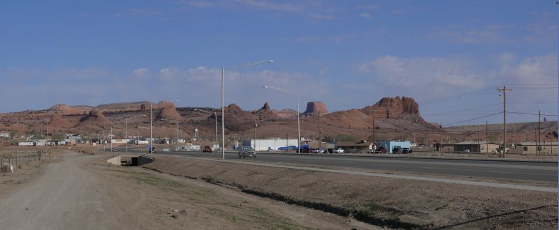
| 08 | Km 1410 - Kayenta [night at the Best Western, breakfast at the Blue Coffee Pot] | |||||
| ||||||
| Day #04 - Mon, 19/03/2007 | ||||||
| Km 1410 - (US-163) | ||||||
| Km 1446 - Utah | UT |  |  | |||
| Km 1446 - Navajo Indian Reservation | ||||||
| 09 | Km 1446 - Monument Valley | |||||
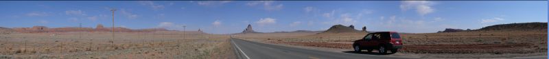
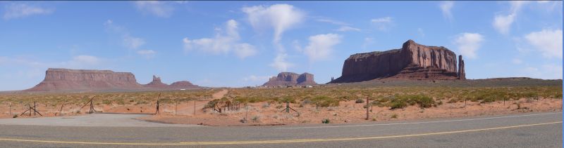
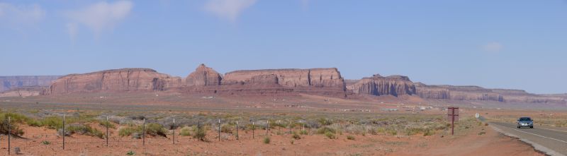

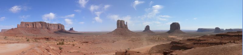
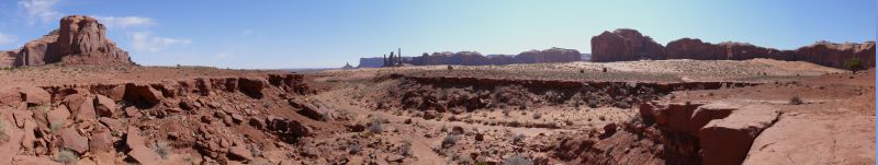
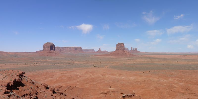
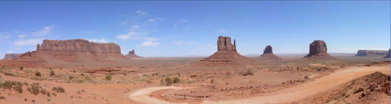
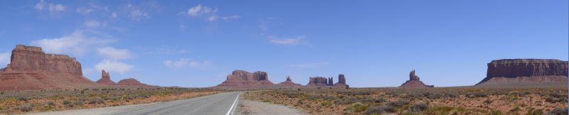
| ||||||
| Km 1447 - Arizona | AZ | | | |||
| Km 1447 - Navajo Indian Reservation | ||||||
| Km 1484 - US-160 | ||||||
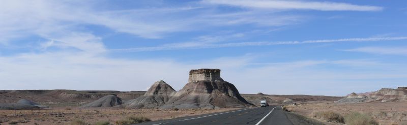
| Km 1601 - Tuba City | ||||||
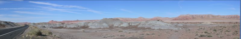
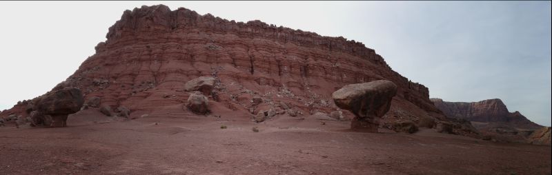
| 10 | Km 1510 - Painted Desert | |||||
| ||||||
| Km 1618 - US-89 | ||||||
| Km 1687 - (US-89A) | ||||||
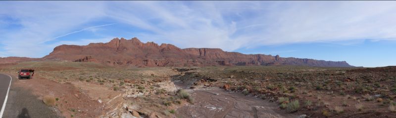
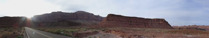
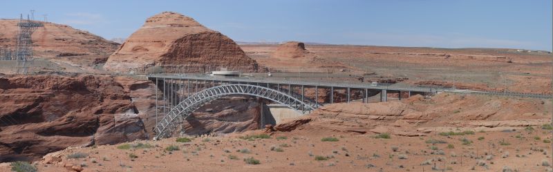
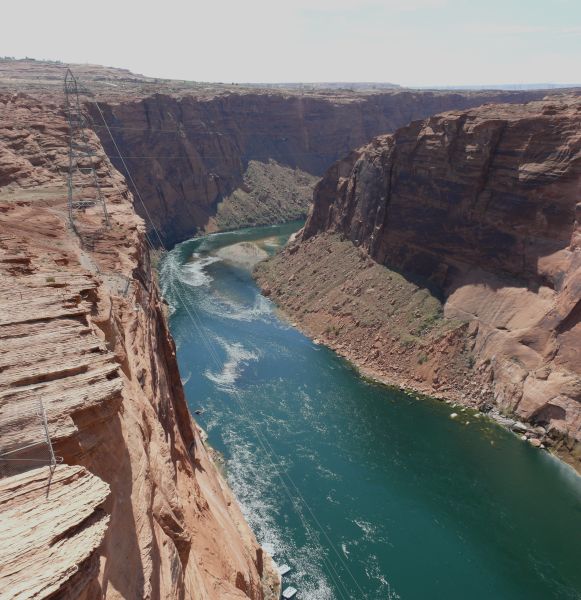
| 11 | Km 1710 - Marble Canyon: Navajo Bridge | |||||
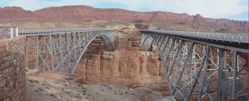 | The first bridge, the one upstream (on the right side in the picture), was opened to traffic in 1929 and is 616 ft long while the second, the one downstream (on the left side in the picture), was opened in 1995 and is 725 ft long and almost twice as wide as its predecessor. The height from the river is 466 ft. The new bridge became necessary because of the increased traffic on US-89A (traffic is really heavy as you can see :-)) and the original bridge was left as a pedestrian crossing. | |||||
| Km 1710 - Marble Canyon: Colorado River | ||||||
 | ||||||
| 11 | Km 1710 - Marble Canyon: Vermillion Cliffs | |||||
| ||||||
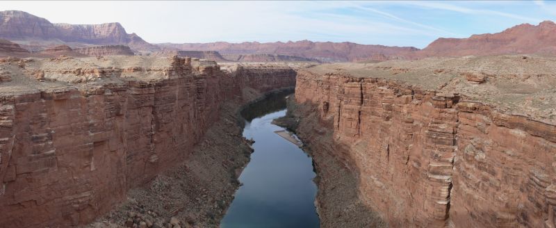
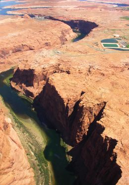
| 11 | Km 1717 - Marble Canyon: Colorado River at Lee's Ferry | |||||
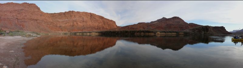
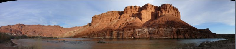
| This is were the Paria River flows into the Colorado and the north rim slopes down from a 500 ft cliff to a beach, making this the only place where you can cross the Colorado in over 600 miles. For this reason, in 1871 the Church of Jesus and the Latter Day Saints (that is, the Mormon Church in Utah) financed John D. Lee so he could build a ferry service here to connect Southern Utah to Arizona. The ferry lasted until 1928, when the Navajo Bridge was build. However John D. Lee is better known for his part in the Massacre of Mountain Meadows in 1857. | |||||
During the second quarter of the '800, following the teachings of Joseph Smith, the Mormon religion was born in the US. Mormons were discriminated against from the start so they gathered in the Western state of Utah, at the time, like other Western states, far from the reach of the Federal Government. During the summer of 1857, the Federal Government began advancing troops to regain control of Utah and the Mormon Governor declared martial law. That was the time when a caravan of colonists from Arkansas started on its march towards California, because of personal and commercial reasons as well as because of the gold rush. On their route they had to cross most of Utah from north-east to south-west. When they were already close to the Nevada border, in Washington county (where Zion National Park, Hurricane and St. George are, all places we passed through later on), they were massacred by a band of Mormons led by John D. Lee himself. The reason behind the massacre, in which 100-150 civilians were killed, is not clear, that is some witnesses stated the killers thought the colonists really were spies and/or federal soldiers in disguise or that they had received the order from the Mormon Governor himself. Clearly the Mormon Church always denied the allegations (however, if they had learnt anything from the Roman Catholic Church of centuries past, one always denies until proven otherwise and even after that). | ||||||
| Km 1717 - Marble Canyon: Colorado River | ||||||
| Km 1748 - US-89 | ||||||
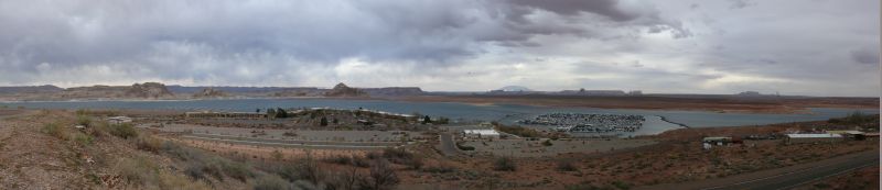
| 12 | Km 1792 - Page [night at the Best Western, dinner at Danny's] | |||||
| ||||||
| Day #05 - Tue, 20/03/2007 | ||||||
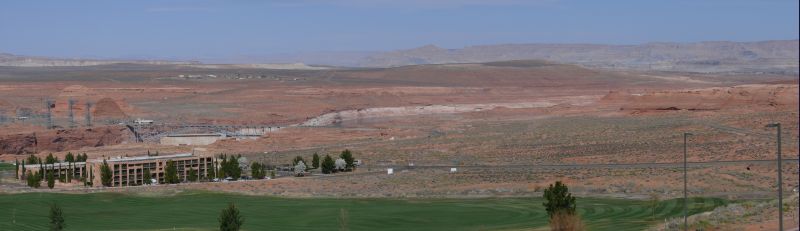
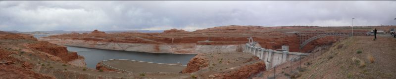
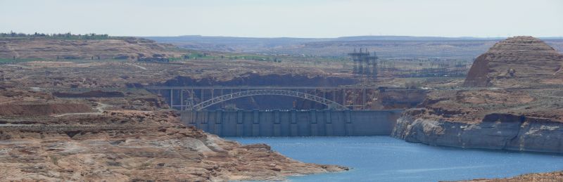
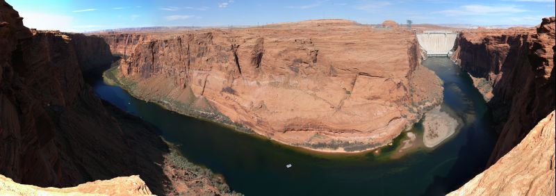
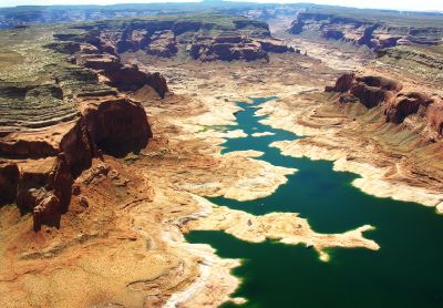
| 12 | Km 1794 - Glen Canyon: Glen Canyon Dam and US-89 Bridge | |||||
| ||||||
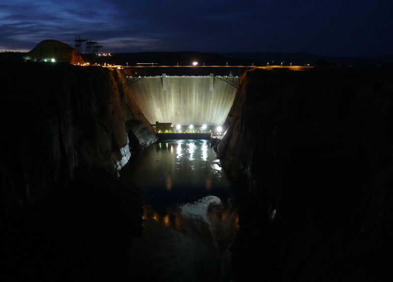 | Since I didn't kill myself climbing the rocks on the rim of the Royal Gorge despite the strong wind, I decided to try again climbing for 300 ft among the rocks in the dark to the canyon rim. As I discovered the next morning, there was a lookout point reachable by an easy trail not 150 ft on my left. Going down was not too hard, since there was still a little bit of light and I could use the dam to pinpoint the direction, but coming back up was harder because of the darkness and I didn't know exactly were I was going. And the brilliant idea of shooting the brights in my face the 3 I left in the car had did not help in the least. However the pictures came out alright despite the bats that were trying to make me fall into the river below. | |||||
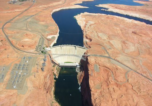  | I took these aerial pictures last year. | |||||
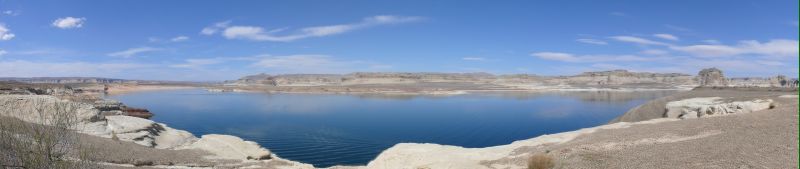
| Km 1794 - Glen Canyon: Colorado River | ||||||
| ||||||
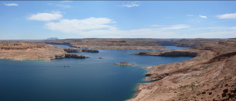
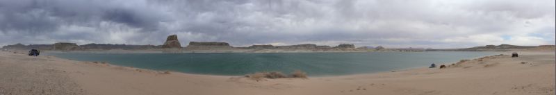
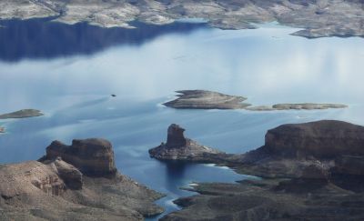
| 13 | Km 1805 - Lake Powell: Wahweap Bay | |||||
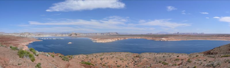
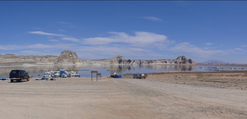
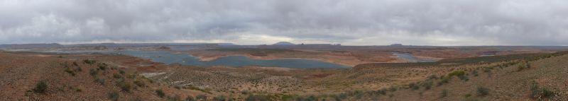
| ||||||
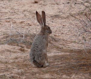 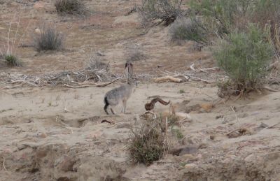
| We saw some hares. | |||||
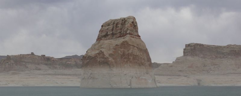
| 13 | Km 1805 - Lake Powell: The Lone Rock | |||||
| ||||||
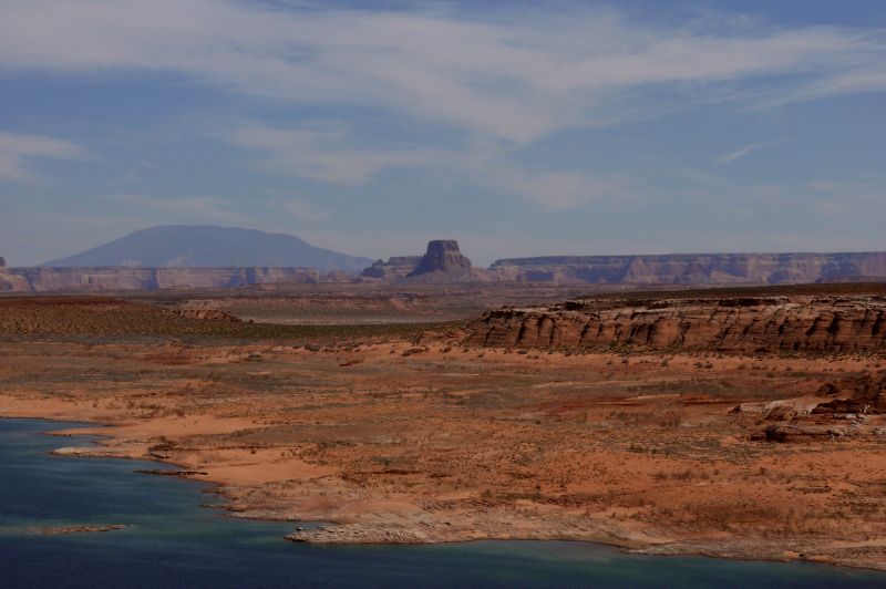
| 13 | Km 1805 - Lake Powell: Tower Butte | |||||
| ||||||
| 13 | Km 1805 - Lake Powell | |||||
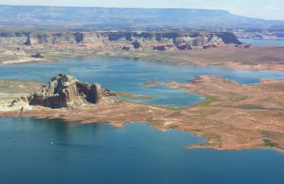 
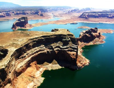 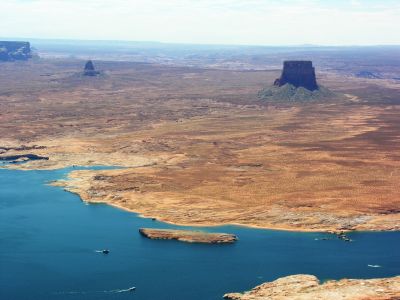
| I took these aerial pictures last year. | |||||
| Km 1816 - Utah | UT | | | |||
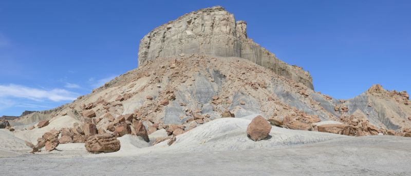
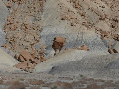
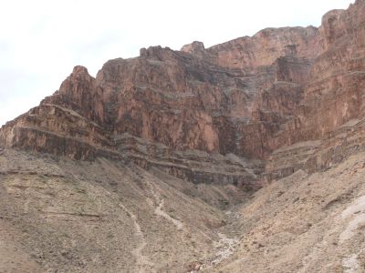
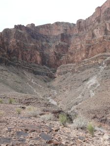
| 13 | Km 1863 - Glen Canyon: Crosby Canyon (beneath the slopes of Escalante) | |||||
  | ||||||
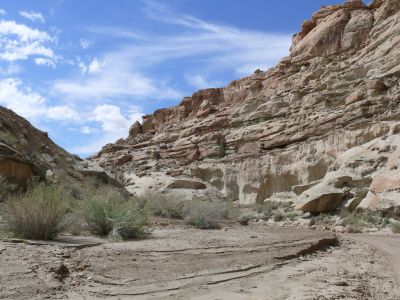 
| Listening to my passengers' complaints, it seemed like I had led them to certain death when I drove into this canyon. | |||||
| To tell it in full, the complaints had started long before that, at the beginning of the dirt road, when I forded a stream (because of the draught, there might have been a whole inch of water, tops!), as you can see in the bottom left corner. | |||||
| 13 | Km 1898 - Big Water | |||||
| <geek mode="on">We crossed the Shire!</geek> | |||||
| Km 1910 - Arizona | AZ | | | |||
| Km 1924 - Glen Canyon: Colorado River | ||||||
| 12 | Km 1925 - Page [night at the Best Western, dinner at the Glen Canyon Steakhouse] | |||||
| Day #06 - Wed, 21/03/2007 | ||||||
| Km 1927 - Glen Canyon: Colorado River | ||||||
| Km 1940 - Utah | UT | | | |||
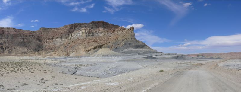
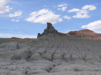
| Km 1994 - Escalante-Grand Staircase National Monument | ||||||
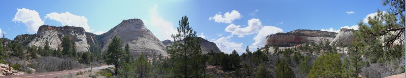
| Km 2071 - (SR-9) | ||||||
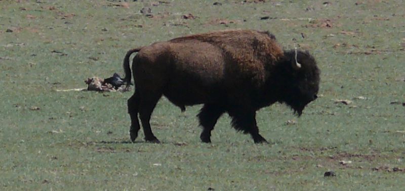
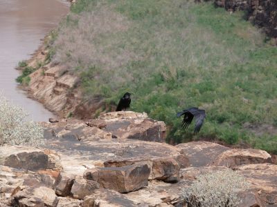
| A couple of buffalos in a field along the road. Behind the buffalo you can see a large black bird pecking at a carcass. | |||||
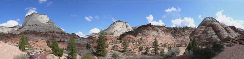
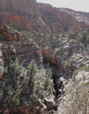
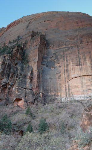
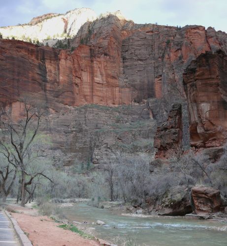
| 14 | Km 2113 - Zion National Park: Checkerboard Mesa | |||||
| ||||||
| The rock texture clearly explains the name Checkerboard Mesa. | |||||
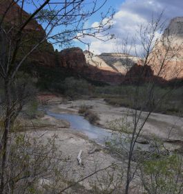
| 14 | Km 2113 - Zion National Park: Zion Canyon | |||||
| ||||||
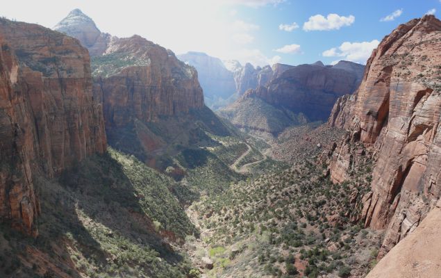
| 14 | Km 2113 - Zion National Park: The Great Arch | |||||
| The arch is actually a cave and not a rocky arch and you can see it in the center of the picture, at the end of the canyon. | |||||
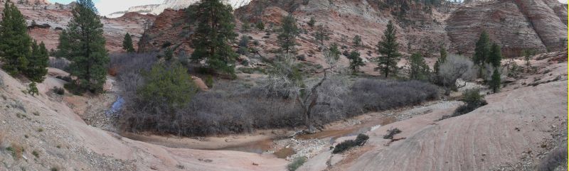
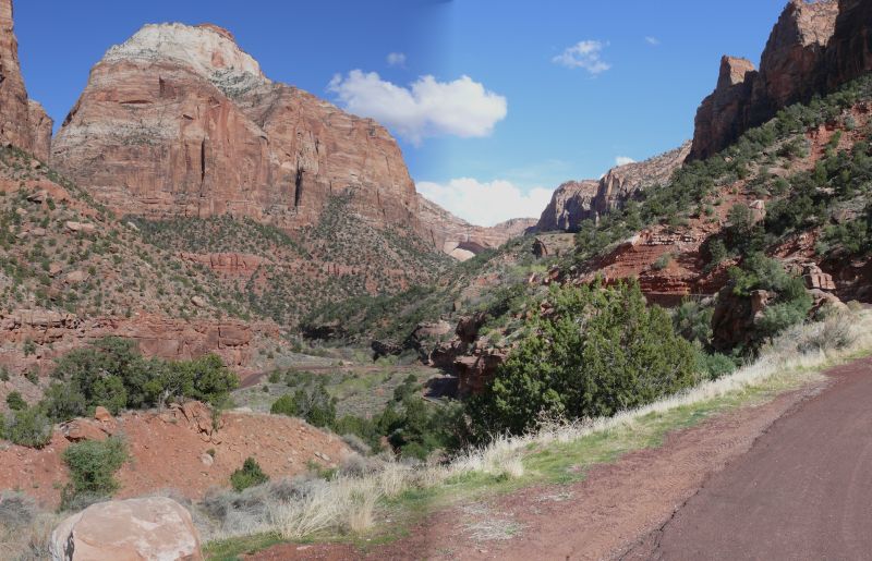
| 14 | Km 2113 - Zion National Park: Emerald Pools | |||||
| Zion Canyon seen from the trail to the Lower Emerald Pools. | |||||
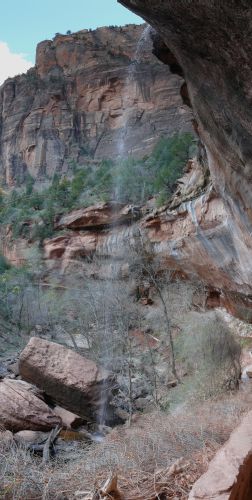 
| On the left, the almost dry fall of the Lower Emerald Pools. On the right, the rock wall around the Upper Emerald Pools. | |||||
| ||||||
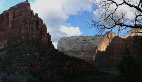
| 14 | Km 2113 - Zion National Park: Temple of Sinawava | |||||
| ||||||
| Km 2123 - Sringdale: Majestic View Lodge [dinner] | ||||||
 | The name of this restaurant/hotel is well deserved. The view in the background is the exit of the Zion Canyon. Inside the restaurant there's a showroom with stuffed animals of North America which is not half bad (if you can forget the fact that they did have to kill the animals to build the showroom). | |||||
| 15 | Km 2162 - Hurricane [night at the Days Inn] | |||||
| Day #07 - Thu, 22/03/2007 | ||||||
| Km 2173 - I-15 | ||||||
| 16 | Km 2190 - St. George [breakfast at the Cracker Barrell] | |||||
| Km 2201 - Arizona | AZ | | | |||
| Km 2210 - Virgin River | ||||||
| Km 2230 - Mojave Desert | ||||||
| Km 2248 - Nevada | NV |  |  | |||
| 18 | Km 2380 - Las Vegas | |||||
| Km 2391 - (I-215) | ||||||
| Km 2410 - (US-93) | ||||||
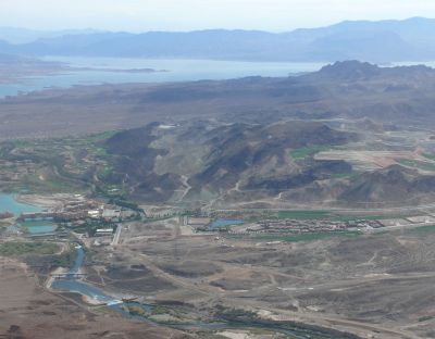
| Km 2430 - Boulder City | ||||||
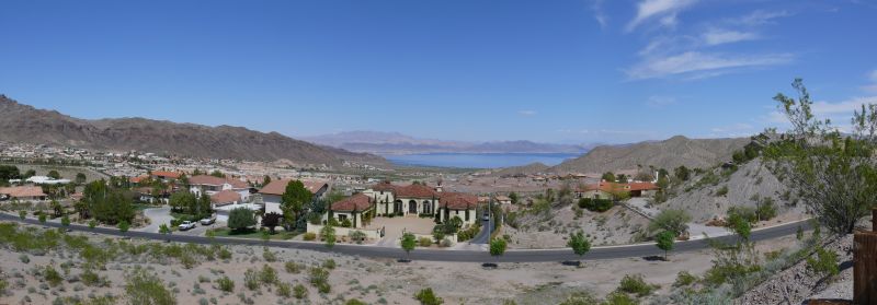 | Boulder City is the small town build around the settlement of the Hoover Dam workers in the '30s. Gambling was prohibited inside the settlement and it still is today, making Boulder City unique in the state of Nevada. The prohibition is not however a real obstacle to gambling, since Las Vegas is only 30 miles away and, even closer, there are casinos in every direction within a 10 minute drive, just outside the town limits. | |||||
| Km 2442 - Arizona | AZ | | | |||
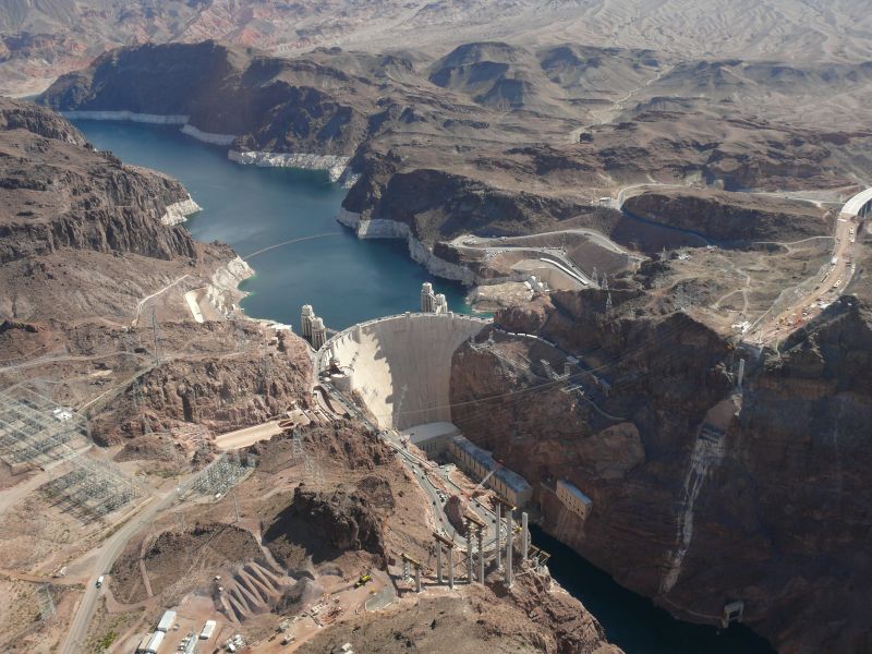
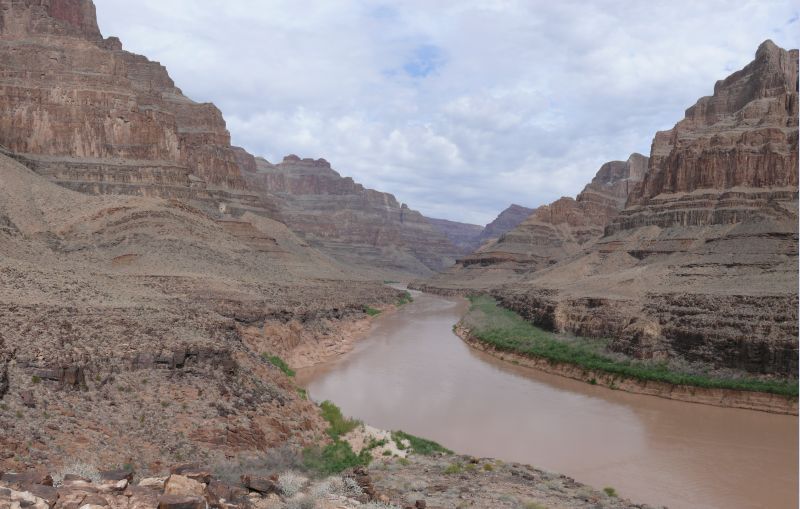
| 17 | Km 2442 - Black Canyon: Colorado River | |||||
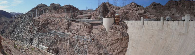
  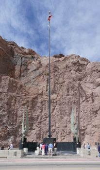
| The river marks the border between Nevada and Arizona, so the dam is the state line along the US-93. Since the dam can no longer sustain the increased traffic on US-93, they are building a new bridge, whose piers on the Nevada side can be seen in the pictures (e.g. in the top left corner of the first picture). The monument in the lower right corner is placed on the Nevada side. Since there are no ancient statues here, according to the local tradition touching the feet of the sphinx is supposed to bring luck, mimicking some ancient European traditions. | |||||
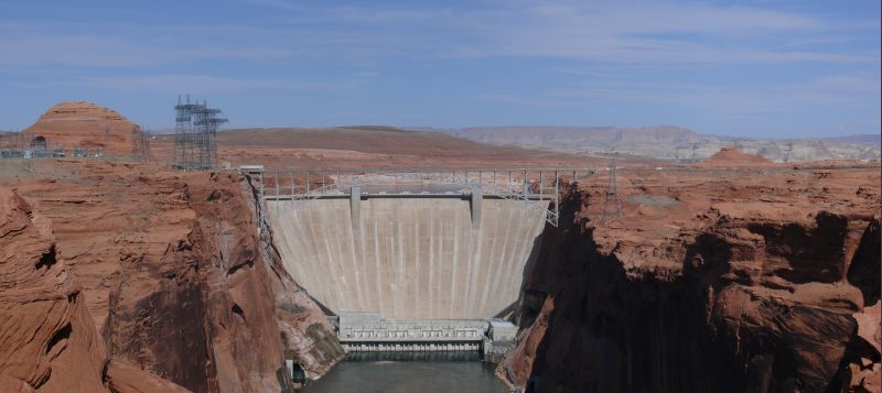
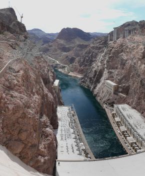
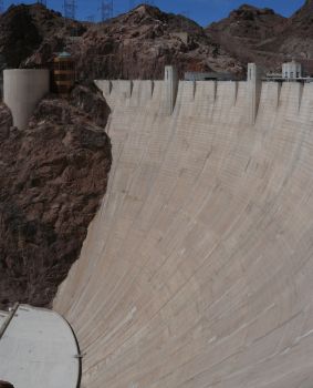
| 17 | Km 2442 - Black Canyon: Hoover Dam | |||||
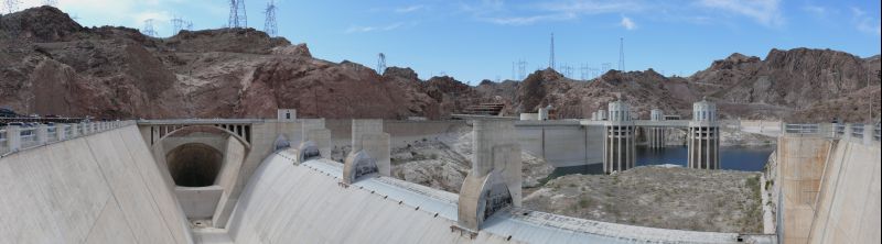
| To build the idroelectric dam in 1931, they had to divert the Colorado river flowing at the bottom of the Black Canyon. To diver it, they dug 4 tunnels inside the canyon walls (2 on each side), 55 ft wide and for a total of over 3 miles in length. The dam was completed in 1936, 2 months earlier than scheduled. 2 of the tunnels have been adapted to carry the water from the 2 outermost intake towers (visible behind the dam) to the turbines and the other 2 as spillways, to prevent the lake from overflowing the dam (they have been used only twice, in 1983 and 1999). | |||||
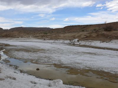
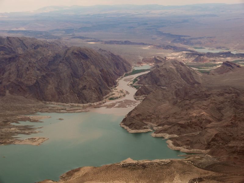
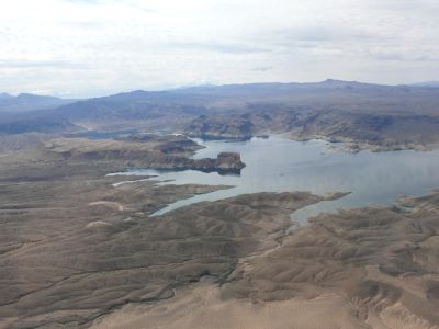
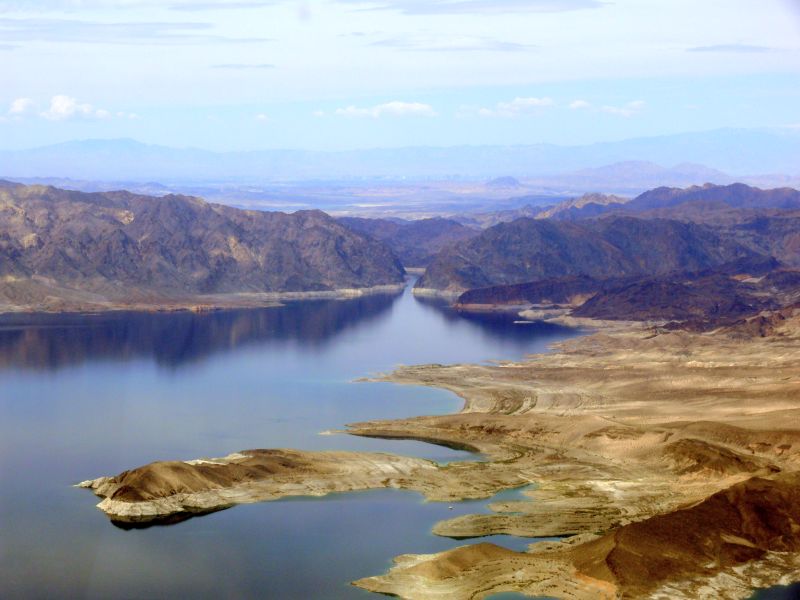
| 17 | Km 2442 - Black Canyon: Lake Mead | |||||
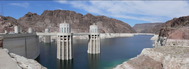 | The white stripes (I think they are salt deposits) mark the normal water level, but the present level (as well as the levels of Lake Powell and the whole Colorado River) is much lower because of the limited amount of rain on the Rockies and the general draught in the Southwest. | |||||
| Km 2442 - Nevada | NV | | | |||
| Km 2464 - (I-515) | ||||||
| 18 | Km 2492 - Las Vegas: Luxor Resort and Casino [night at the Luxor, dinner at the Ellis Island] | |||||
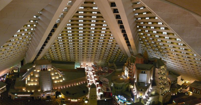 | The Luxor is a huge hollow glass pyramid. The casino and the attractions are inside the cave-like interior and the rooms are placed on the walls (and in 2 external buildings). There's a sphynx and an obelysk before the entrance. | |||||
| Day #08 - Fri, 23/03/2007 | ||||||
| (helicopter) - Arizona | AZ | | | |||
| (helicopter) - Hualapai Indian Reservation | ||||||
| 17 | (helicopter) - Hoover Dam | |||||
 | ||||||
| 17 | (helicopter) - Lake Mead | |||||
 | The ingress of the Colorado River into the lake, with the sand deposits carried by the river. | |||||
| ||||||
 | The Narrows, where the lake is narrowest. The initial plan for the dam was to build it here, but it was later decided it was best to build it further downstream, in the Black Canyon. | |||||
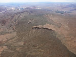
| (helicopter) - Grand Canyon West | ||||||
| ||||||
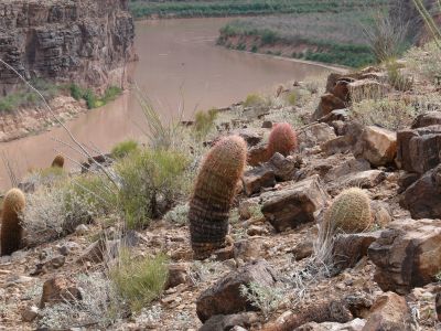 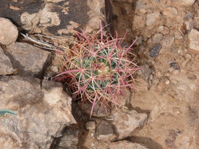 | Some catci, seen everywhere from Colorado to Nevada. These were the largest ones. | |||||
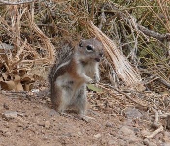 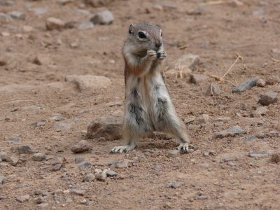 | According to the pilot, this antelope-squirrel is always around on the landing platform, waiting for crumbs, which are obviously plentiful given that tourists are easy to captivate. | |||||
 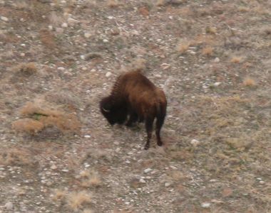 | Finally a wild buffalo seen from the helicopter. The pilot flew over the highland between the Grand Canyon and Lake Mead trying to find some. | |||||
| (helicopter) - Grand Canyon West: Colorado River | ||||||
| ||||||
| 17 | (helicopter) - Lake Mead | |||||
| (helicopter) - Nevada | NV | | | |||
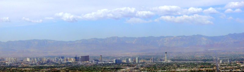
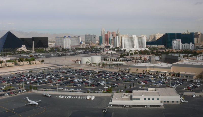
| 18 | (helicopter) - Las Vegas: Downtown | |||||
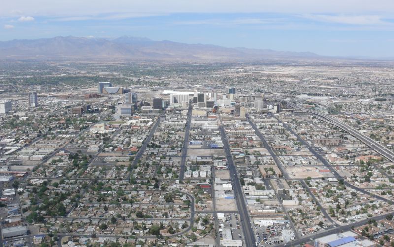 | ||||||
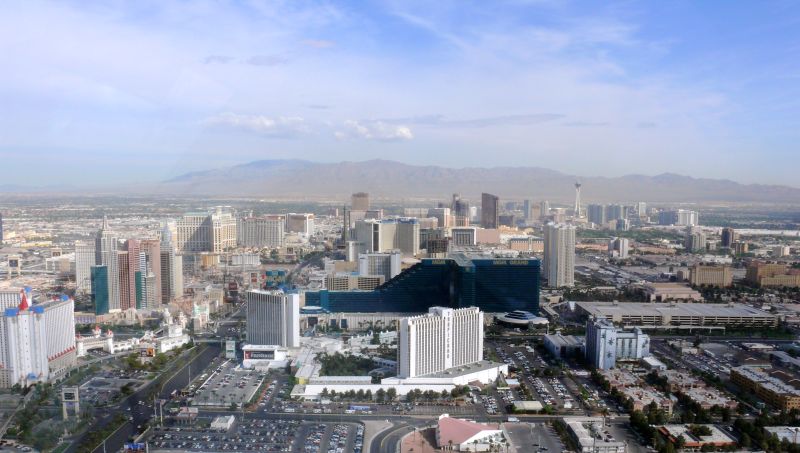
| 18 | (helicopter) - Las Vegas: The Strip | |||||
 | ||||||
| 18 | Km 2492 - Las Vegas: Luxor Resort and Casino [night at the Luxor, dinner at the Rio] | |||||
| ||||||
| Day #09 - Sat, 24/03/2007 | ||||||
| Km 2492 - Las Vegas: The Strip [dinner at the Bellagio] | ||||||
 | The New York New York on the left and the entrance to the MGM Grand on the right. If I am not mistaken, the rollercoaster around the the New York New York is where Grissom from CSI goes to unwind and think. | |||||
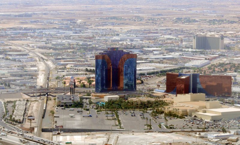 | The Rio. | |||||
 | The South Strip. | |||||
 | The North Strip. | |||||
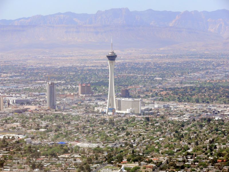 | The Stratosphere. | |||||
| - Km 2496 - | ||||||