Paris >>> San Francisco |
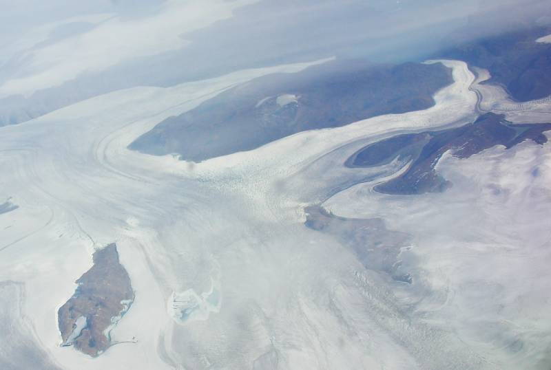 |
The iceshelves of Greenland (Paris-San Francisco is an Arctic route).
|
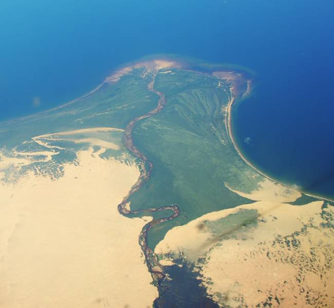 |
The mouth of some river in the Arctic Canada.
|
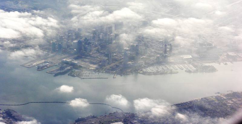
San Francisco, California |
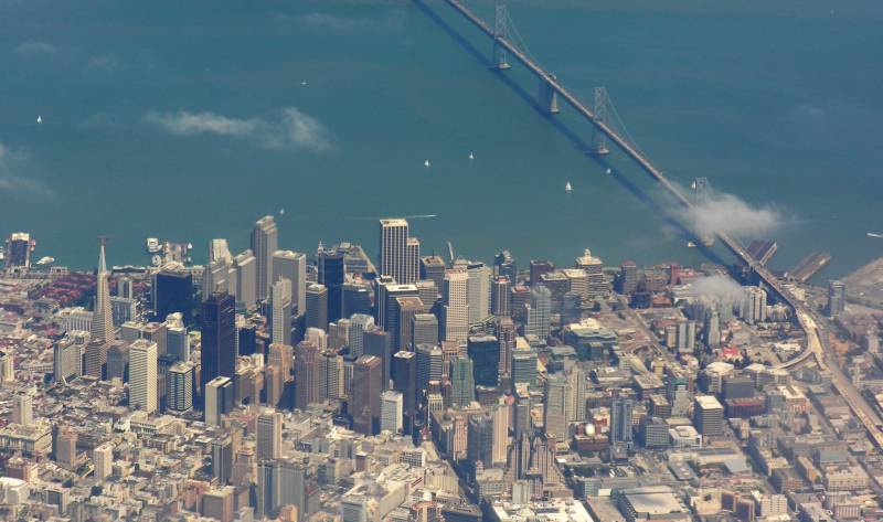 |
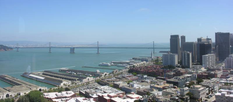
Downtown San Francisco. You can clearly see the Transamerica skyscraper (the pyramid on the left)
and the west segment of the San Francisco-Oakland Bay Bridge.
|
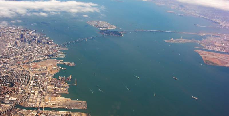 |
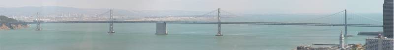
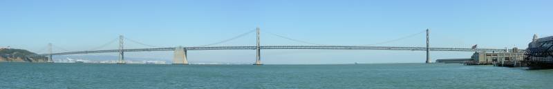
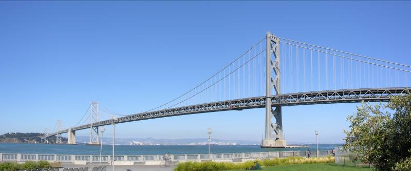
The San Francisco-Oakland Bay Bridge. From the left:
the skyscrapers in Downtown San Francisco, the double suspension bridge,
the island of Yerba Buena, the east segment of the bridge, Oakland.
The whole bridge is over 8 miles long. The suspended spans are 2300 ft long (35th in the world),
totalling 1.7 miles including the anchorages. The towers are 524 ft tall and the road deck is 220 ft above the water level.
|
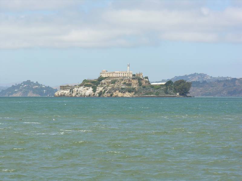 |
Alcatraz Island (that is, the Island of the Pelicans in Spanish).
|
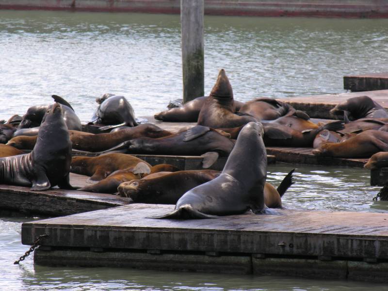 |
The "wild" seals of Pier 39.
|
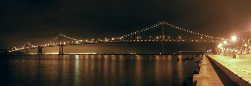 |
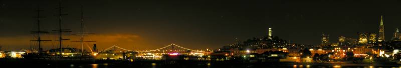
The San Francisco-Oakland Bay Bridge at night.
|
 |
The San Francisco-Oakland Bay Bridge seen from the Coit Tower.
|
 |
The San Francisco-Oakland Bay Bridge.
|
 |
The San Francisco-Oakland Bay Bridge.
|
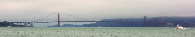 |
The Golden Gate Bridge lost in the fog.
The suspended span is 4200 ft long (8th in the world), totalling 1.7 miles.
The towers are 745 ft tall (taller than many skyscrapers) and the bridge is 220 ft above sea level.
This is the largest suspension bridge open to pedestrians even though there's a strong cold cross-wind blowing over it.
|
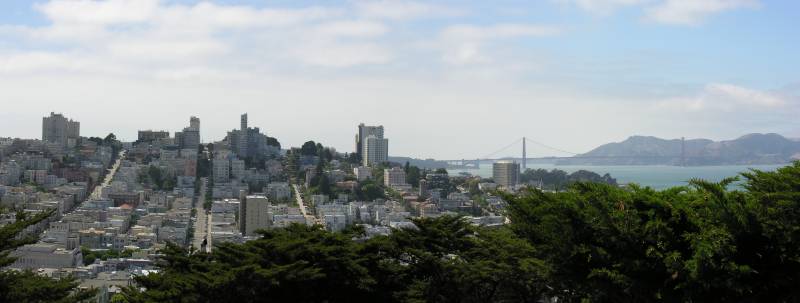 |
Panorama of San Francisco from the Coit Tower on Telegraph Hill, looking west.
On the left, Russian Hill.
On the right, the Golden Gate Bridge at the entrance to the San Francisco Bay (the narrow entrance to the bay is called Golden Gate, hence the naming of the bridge), seen from the Presidio San Francisco in Marin County.
The third large street climbing over the hill, counting from the left, is Lombard Street. You can see the winding top segment decorated with flowers.
|
 |
Panorama of San Francisco from the Coit Tower on Telegraph Hill, looking south.
On the left, the double suspension bridge of the west segment of the San Francisco-Oakland Bay Bridge.
On the right, the skyscrapers in Downtown San Francisco.
|
 |
Panorama of San Francisco from the Coit Tower on Telegraph Hill, looking south.
On the left, the double suspension bridge of the west segment of the San Francisco-Oakland Bay Bridge.
On the right, the skyscrapers in Downtown San Francisco, including the Transamerica pyramid.
|
 |
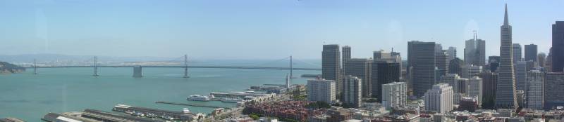
Panorama of San Francisco seen from the Aquatic Park pier.
In the background, on the left, the San Francisco-Oakland Bay Bridge.
On the right, the Coit Tower on top of Telegraph Hill and the Transamerica pyramid on its right.
|
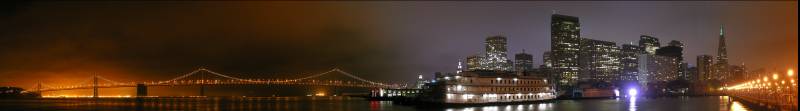 |
On the left, the San Francisco-Oakland Bay Bridge.
On the right, the skyscrapers of Downtown San Francisco.
|
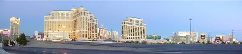
Las Vegas, Nevada |
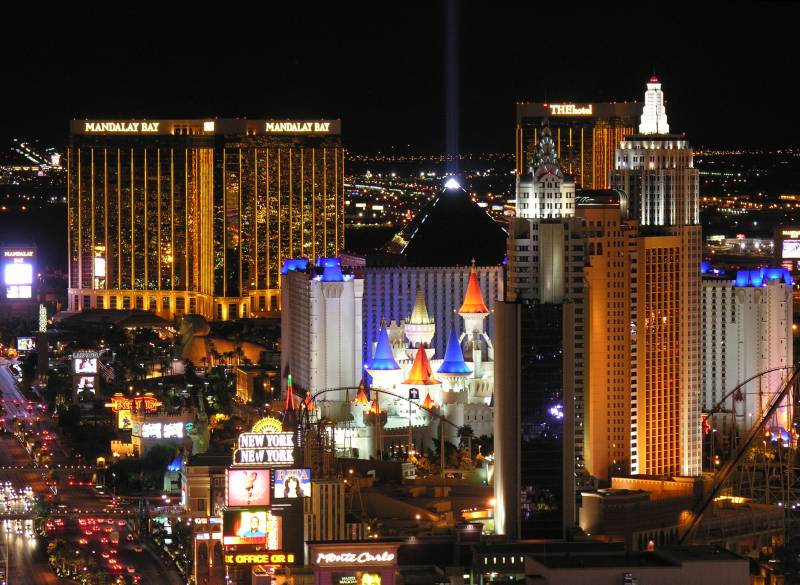 |
The South Las Vegas Strip seen from the Eiffel Tower of the Paris Hotel, looking south.
The large golden building in the background is the Mandalay Bay. Next to it is the black pyramid of the Luxor,
with its light beam pointing skywards (it's powerful enough to be seen from far away)
and the sphynx in front of the entrance. Before the Luxor there's the Excalibur and, in the foreground,
the New York New York, with its mock skyscrapers (the Empire State Building on the right and the Crysler Building on the left),
the Brooklyn Bridge (you can see the towers at the bottom, under the New York New York sign)
and, among other things, you can see the roller coaster arount the hotel (I think it's the one where Grissom goes to unwind and think in CSI).
|
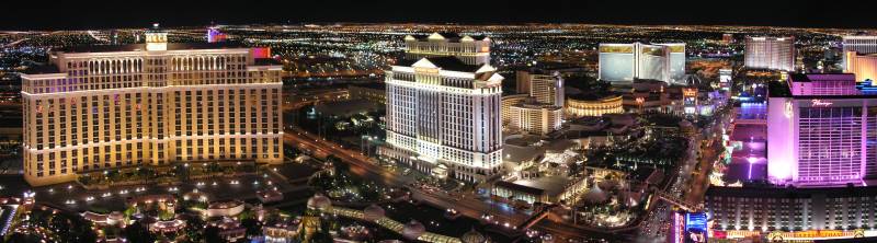 |
The central part of the Last Vegas Strip, at the intersection of South Las Vegas Boulevard end East Flamingo Road,
seen from the Eiffel Tower of Paris Hotel, looking west.
On the left, the Bellagio.
In the center, the Caesar's Palace.
On the right, the Flamingo (in pink).
|
 |
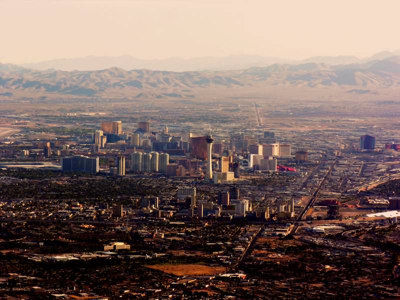
The whole Strip seen from the Stratosphere Hotel's tower, at the northern end of the Strip.
|
 |
The Strip seen just before sunrise from the plane.
|
 |
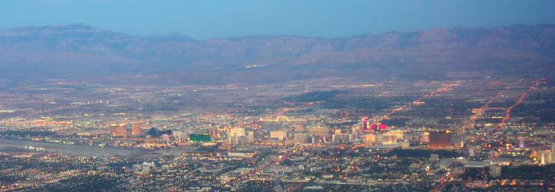
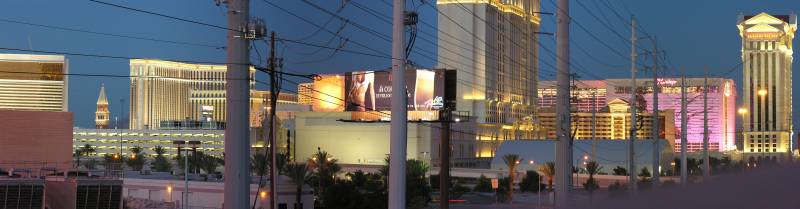
The Strip seen at dusk from the plane.
In the center, the Stratosphere tower, which is the tallest building west of the Mississippi at 1150 ft.
|
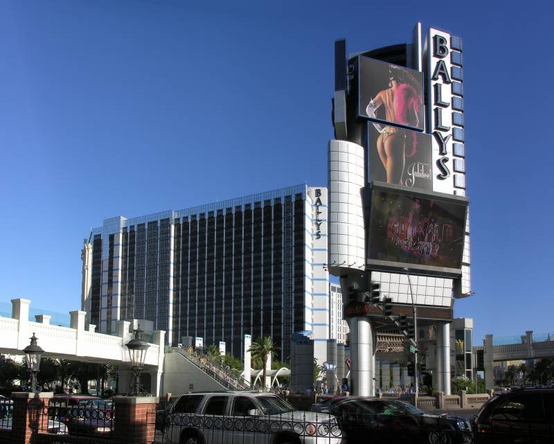 |
The Bally's Hotel. This is the side my room was on.
|
 |
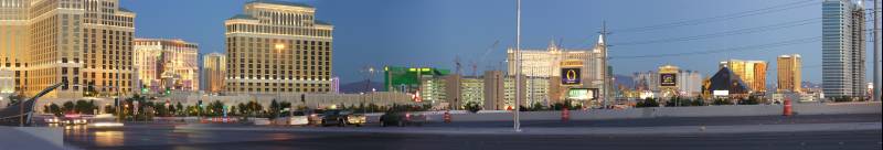
The back of the Strip seen from I-15, looking east.
On the left you can spot the top of the Campanile di San Marco of the Venetian hotel.
On the right, the buildings of the Caesar's Palace.
|
 |
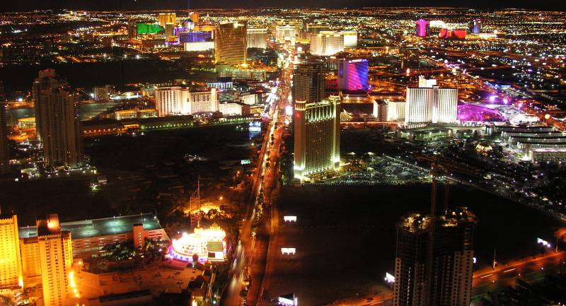
The back of the Strip seen from I-15, looking south-east.
On the left, the buildings of the Bellagio.
In the middle, the green building of the MGM Grand and, on its right, the mock skyscrapers of the New York New York.
On the right, the pyramid of the Luxor and the golden building of the Mandalay Bay.
|
 |
The back of the Strip seen from I-15, looking south-east.
|
Grand Canyon, Arizona |
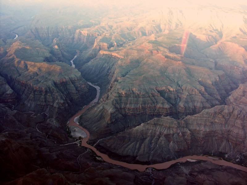 |
The Grand Canyon. The ends of the Granite Park Canyon on the lower left (east) and of the 209 Mile Canyon on the lower right (west) at mile 480 (113.317334° W 35.969010° N). The Colorado River flows from the bottom of the picture (north) towards the top (south).
|
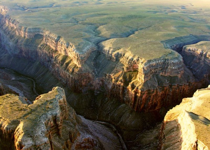 |
The Grand Canyon.
|
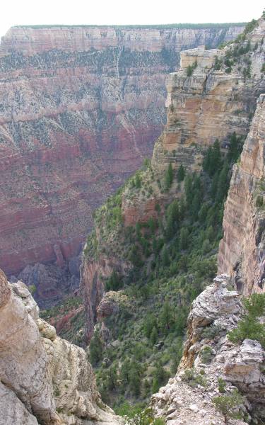 |
The Grand Canyon from Mother Point on the South Rim.
|
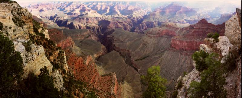 |
The Grand Canyon from Mother Point on the South Rim.
|
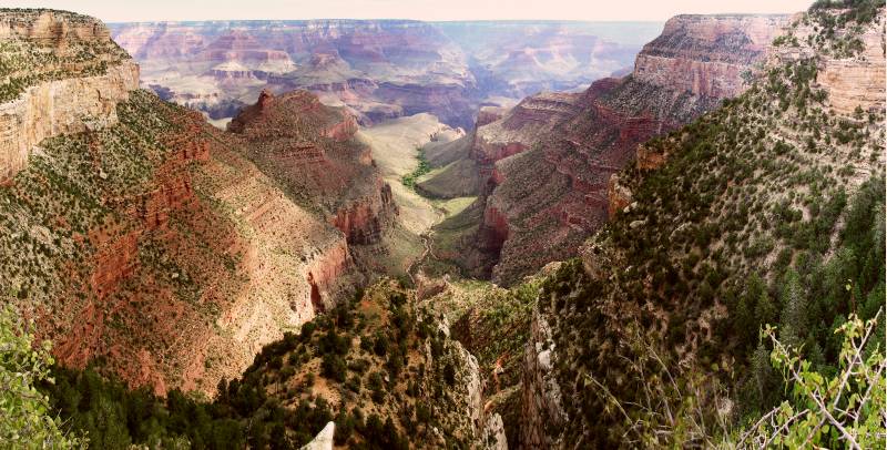 |
The Grand Canyon from Bright Angel Trailhead on the South Rim.
|
Lake Powell, Arizona |
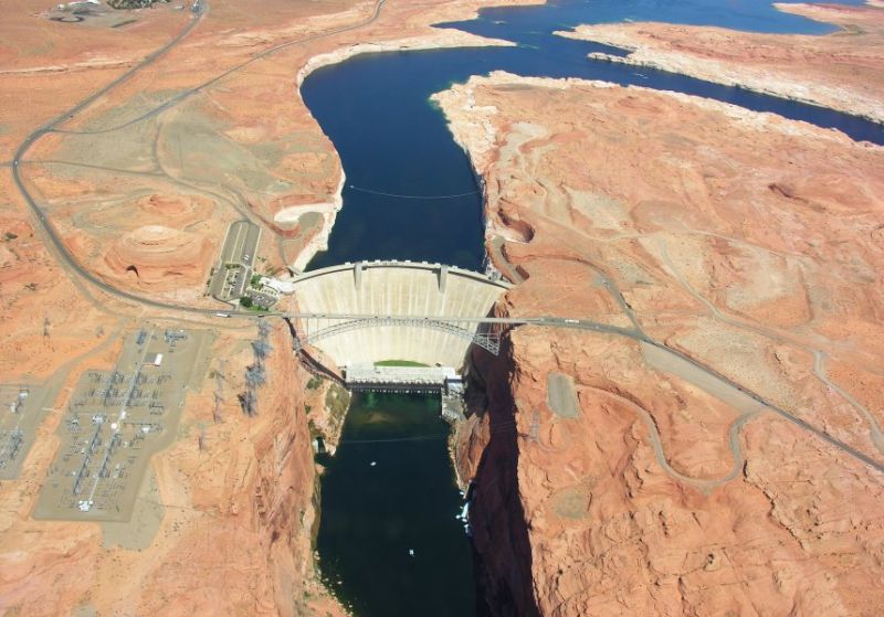 |
The Glen Canyon Dam in Page, Arizona, near the Arizona/Utah border.
|
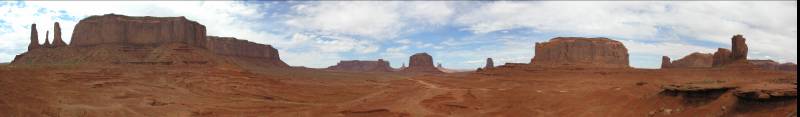
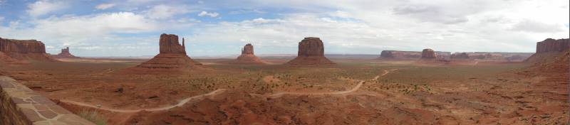
Monument Valley, Arizona |
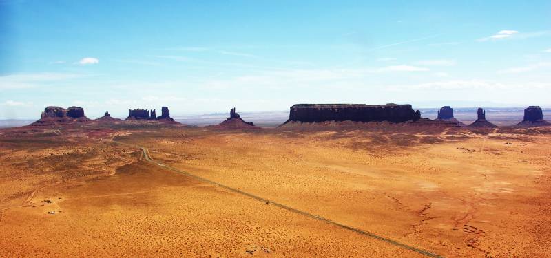 |
The Monument Valley on the Arizona/Utah border.
|
 |
The Monument Valley on the Arizona/Utah border.
|
 |
The Monument Valley on the Arizona/Utah border.
|
Calico, California |
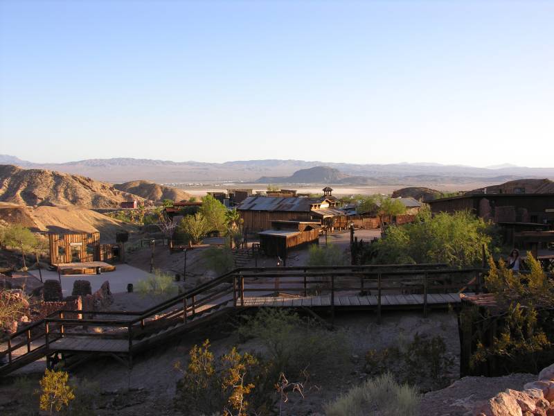 |
The ghost town of Calico near Barstow, California.
|
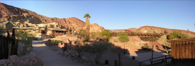 |
The ghost town of Calico near Barstow, California.
The green hut on the left is entirely made of glass bottles.
|
Los Angeles, California |
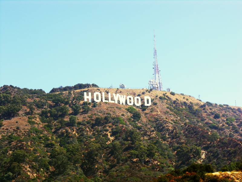 |
The Hollywood Sign.
|
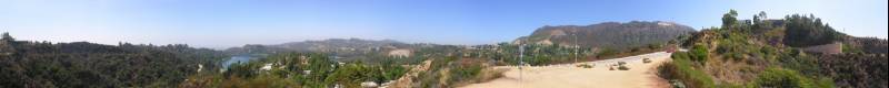 |
Panorama of the south slope of Mount Lee.
On the left, the artificial lake of the Hollywood Reservoir (a.k.a. Lake Hollywood), created by the Mulholland Dam.
On the right on the top of Mount Lee, the Hollywood Sign and, among the trees on the rock, Madonna's old house.
|
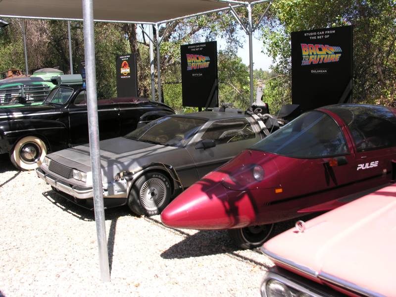 |
Universal Studios Tour: the car from Back to the Future .
|
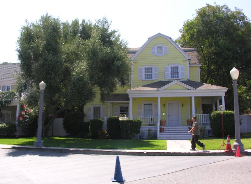 |
Universal Studios Tour: Wisteria Lane from Desperate Housewives .
|
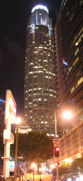 |
The US Bank Tower in Downtown Los Angeles.
|
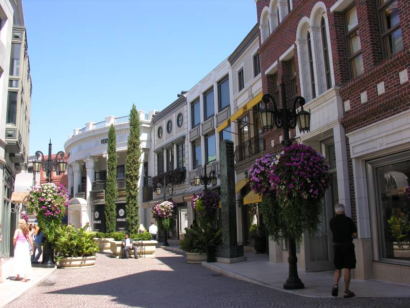 |
2 Rodeo Drive in Beverly Hills.
|
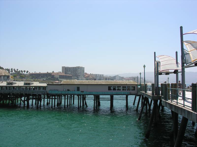 |
The Redondo Coffee Shop on the Redondo Beach Pier in Redondo Beach, near Torrance.
This is were they used to shoot the diner scenes on the pier for The O.C. .
|
San Diego, California |
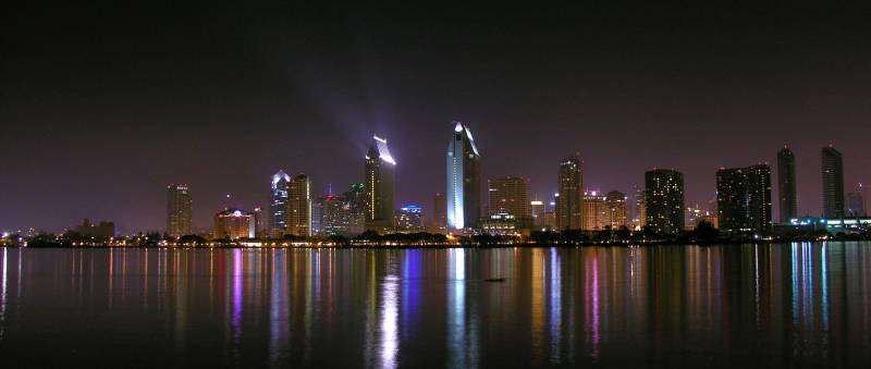 |
Downtown San Diego seen from Coronado.
|
 |
Downtown San Diego seen from the plane.
You can see 2 aircraft carriers: one in the lower left corner and one near the center, among the piers in front of the highrises.
|
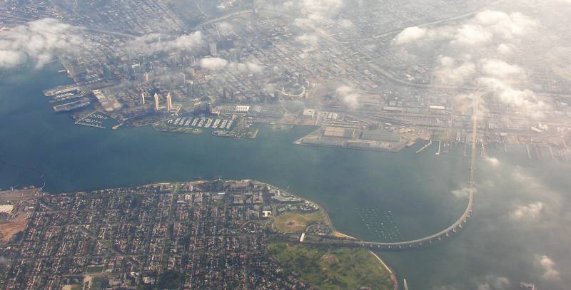 |
Downtown San Diego and Coronado seen from the plane. The Coronado Bridge on the right is over 2 miles long and 200 ft tall in the middle,
with a 4.7% slope (which is quite impressive from up close, like when you are driving over it).
|
San Diego >>> Atlanta |
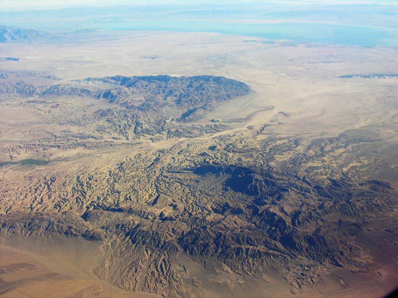 |
The desert of southern California, near Salton Lake. The opening between the mountains is the wash of the Carrizo Creek, between the Fish Creek Mountains on the north (top) side and the Coyote Mountains on the south (bottom) side. The south end of Salton Lake is in the background and the rocky stripe in the middle of the flat West Mesa is the Superstition Mountains. The whole area is part of the Anza-Borrego Desert State Park but most of it is also used by the US Navy for tests, for example the valley immediately west of the mountains (from the middle of the picture to the bottom left corner) is the Carrizo Impact Area, where the navy used to perform aerial bomb drop tests during World War II and the Korean War.
|
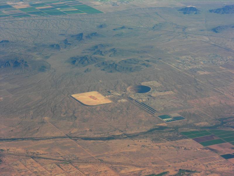 |
Something in Arizona or New Mexico.
|
 |
A cyclon-like storm.
|